

I was fortunate to get a few photos in the last years of Rio Grande operations (which effectively cut off about 1992). At first all I owned was a 110 instamatic camera, but in March 1984 I was given a decent Minolta 35mm unit and the quality of photos improved immensely. I only wish I’d been able to shoot slides too. Some of these photos date from that period– passenger trains, freight trains, scenery, sites and such.
In addition to those, I have added new sections dealing with bridges and tunnels– as many as I have been able to photograph.
As usual, click on the pictures for larger versions.
Go to: Bridges Tunnels Scenery and Sites
Passenger |
Trains |
||
 |
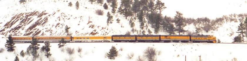
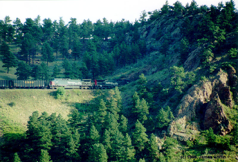
The last operational F-unit on the Rio Grande, F9 No. 5771, leads the Ski Train on March 24, 1984. It’s rounding the curve in Coal Creek Canyon on the way up to Tunnel 1. | ||
 |
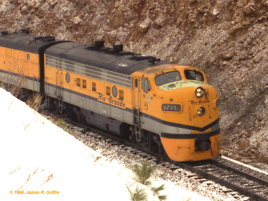
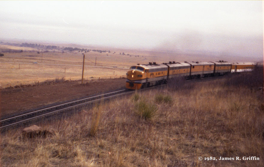
Ski Train Classic: The last Ski Train of the 1984 season rolls through the curves between Coal Creek and Blue Mountain Road on April 8, 1984. As it turned out, although the heavyweight coaches would roll on for three more years, the F9’s would never again appear on this or any other passenger train. They would be permanently retired the following October | ||
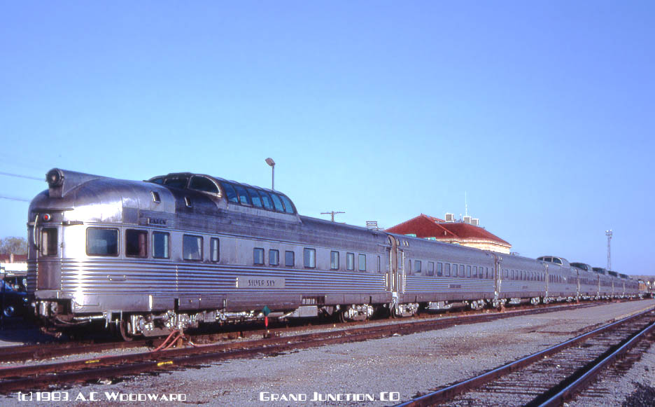 |
Rio Grande Zephyr: The last eastbound run of the RGZ is poised at the Grand Junction depot awaiting its departure. Every stainless car on the roster is on today’s train. Photo by Aubrey Woodward (4/24/1983) | ||
 |
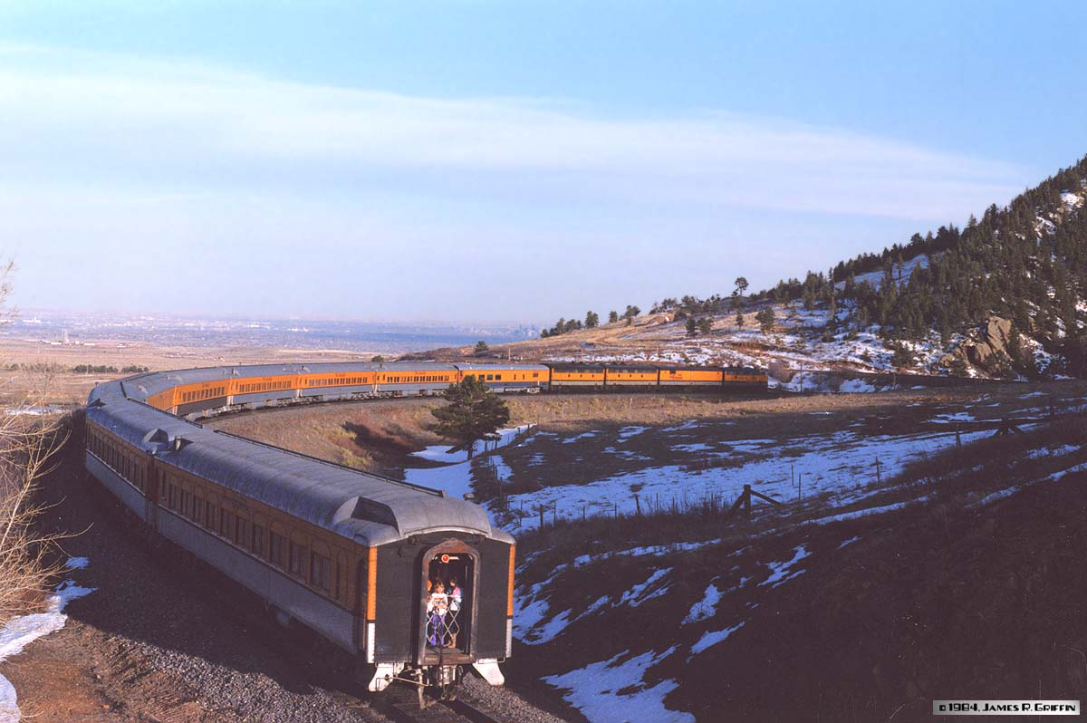
My first “railfan” photo (i.e., going out specifically to photograph a train). The Rio Grande Zephyr rounds the curve between Clay siding and Blue Mountain Road in early January 1982.It was a short train that Saturday. Two of the dome coaches were loaned to the Ski Train (Mayor’s special) that was following 10 minutes behind. | ||
 |
Refer to previous photo: here’s the Ski Train (Mayor’s annual special run), approaching the crossing at Crescent. Two GP40-2’s are the power, and you can see the two stainless steel dome cars at the front of the train. January 1982.The call forms for all of these runs are in a file at the Colorado Rail Museum and I saw the sheet for this day but didn’t make a copy; one day I will get back there and do a little more research. | ||
 |
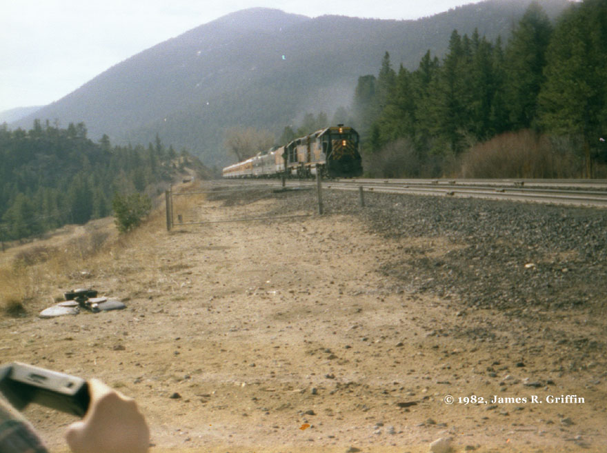
Bitterly cold winds buffet your intrepid photographers and the approaching RGZ at Plain Siding, sometime in early 1982.(Photo by Dan Adams, whose 110 camera was every bit as cheap as mine…) | ||
 |
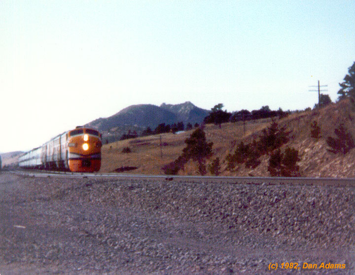
In 1983, Amtrak took over the route of the Rio Grande Zephyr, rerouting its erstwhile San Francisco Zephyr from Wyoming to the D&RGW’s Denver-Salt Lake line (and then renaming the train by co-opting the old California Zephyr‘s moniker). Here it is, not quite a year after the operation began, approaching Coal Creek bridge. It’s a long train; east of Salt Lake it’s the combined CZ / Pioneer / Desert Wind. (3/31/1984- and incidentally the very first frame I shot with my new Minolta) | ||
Freight Trains in Action
|
|||
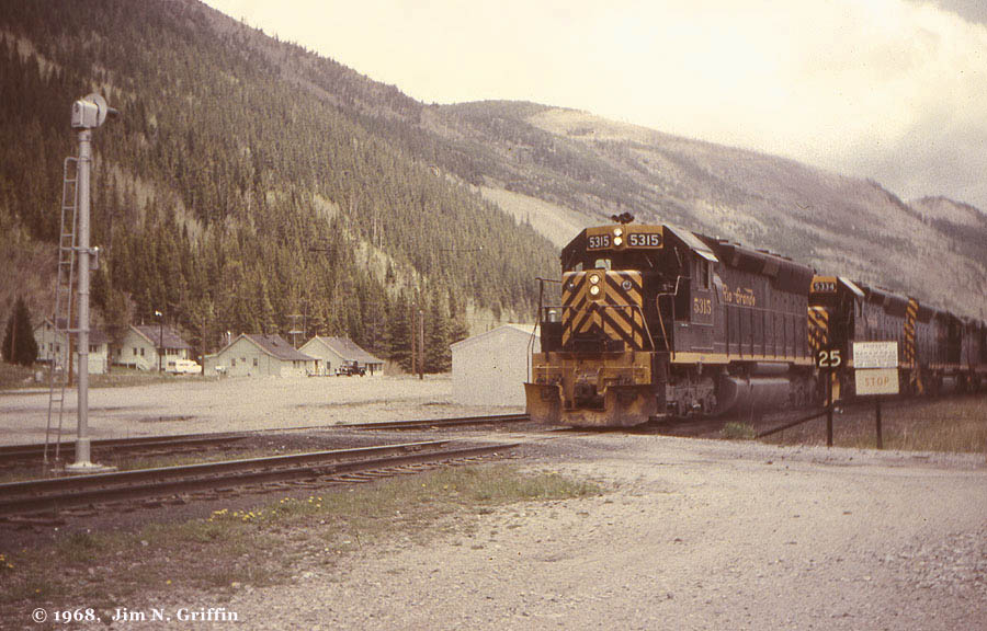 |
In Spring of 1968, a westbound freight powered by a trio of new SD45s approaches the east portal of Moffat Tunnel. The area has changed a lot since that time. (Photo, Jim N. Griffin) |
||
 |
On August 14, 1982, we spotted this coal train on the bypass track at Tabernash, holding for our westbound Rio Grande Zephyr (shot this from the dome). | ||
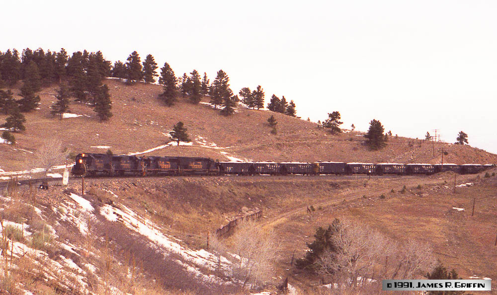 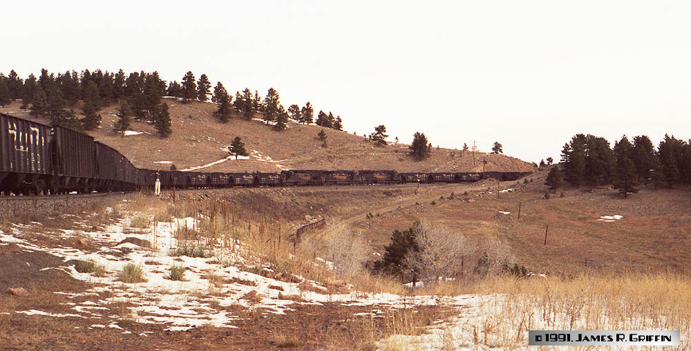 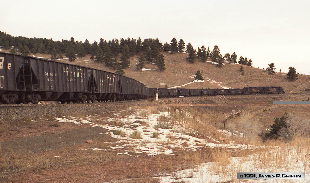 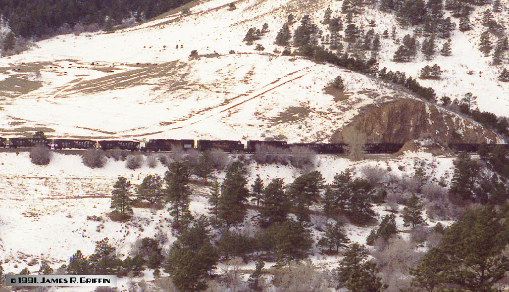 |
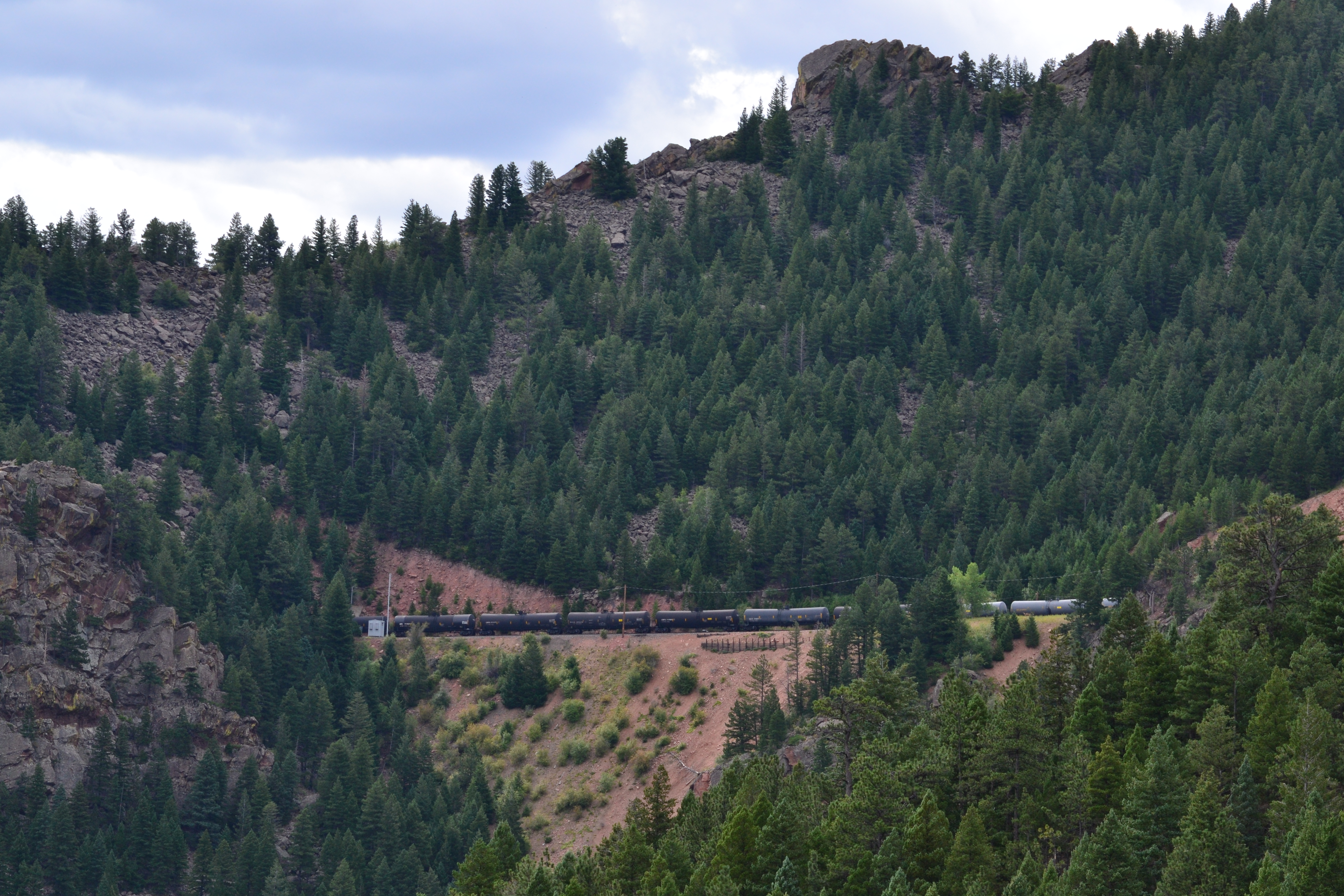
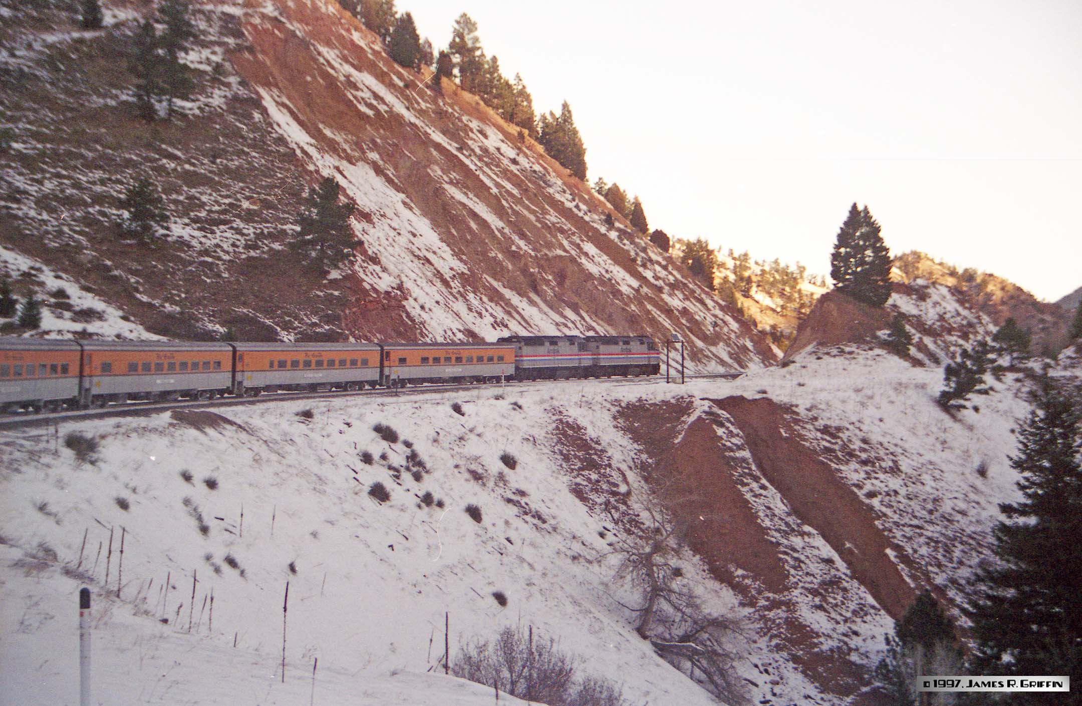
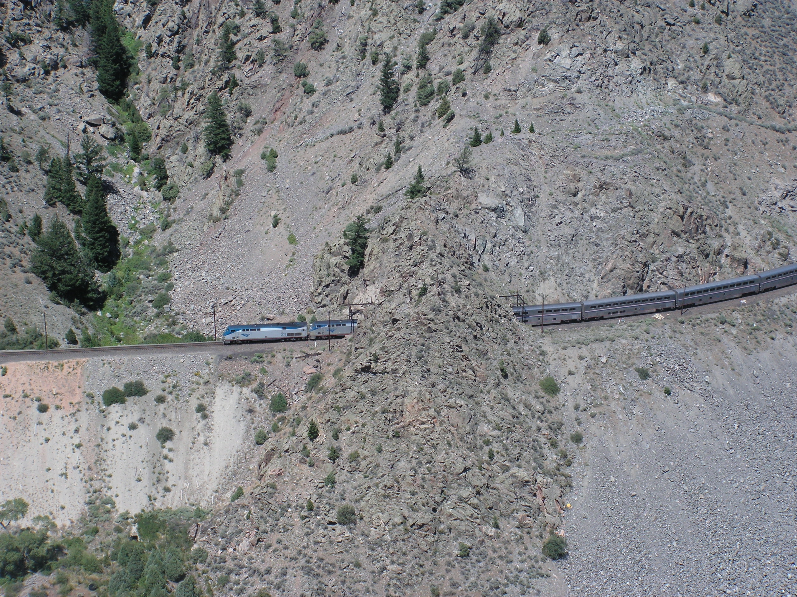
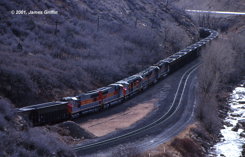
An eastbound coal load with a total of nine locomotives is descending the front range on November 20, 1991. The train consists of 105 company hoppers, mostly Bethlehem quads with a smattering of second-hand cars.Top: It’s coming down the hill between Plain siding and tunnel 1. Two tunnel motors and a pair of SD50s lead it.Top center: three-unit swing helper set: one SD40T-2 and a pair of SD50s.Bottom center: the rear helper pair comes around the corner.Bottom: seen from across the mouth of Coal Creek canyon. I had to run through the tunnel behind the train to achieve this photo. | ||
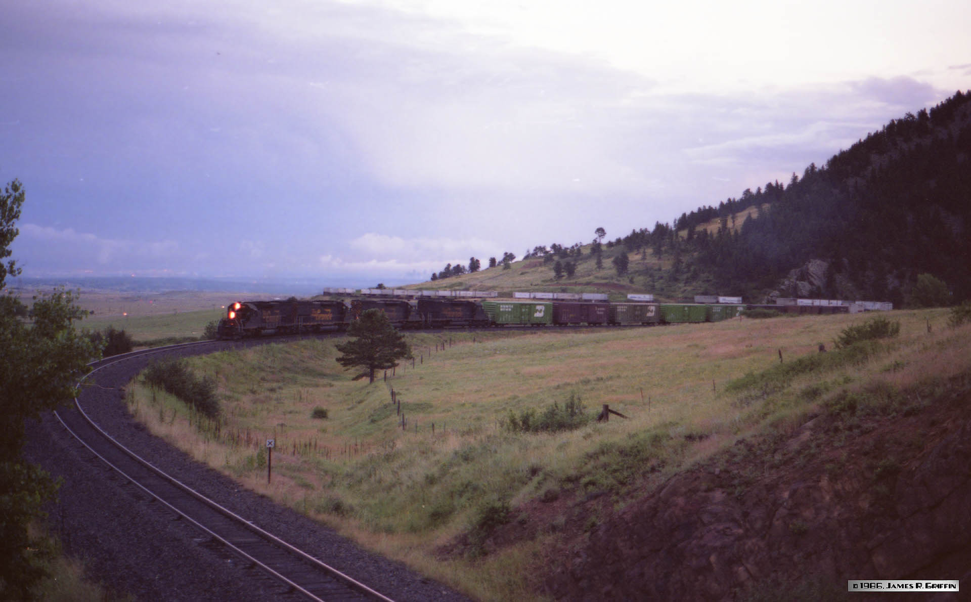 |
Rio Grande train number 101 is hustling westbound across Blue Mountain Road towards Coal Creek Canyon at dusk on a July evening in 1986. For power it has four tunnel motors led by No. 5348; eight insulated boxcars of Coors beer follow, with a long string of piggyback trailers behind. | ||
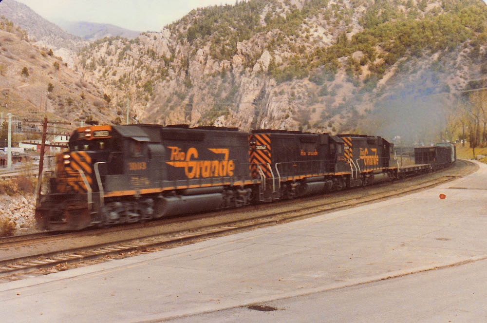 |
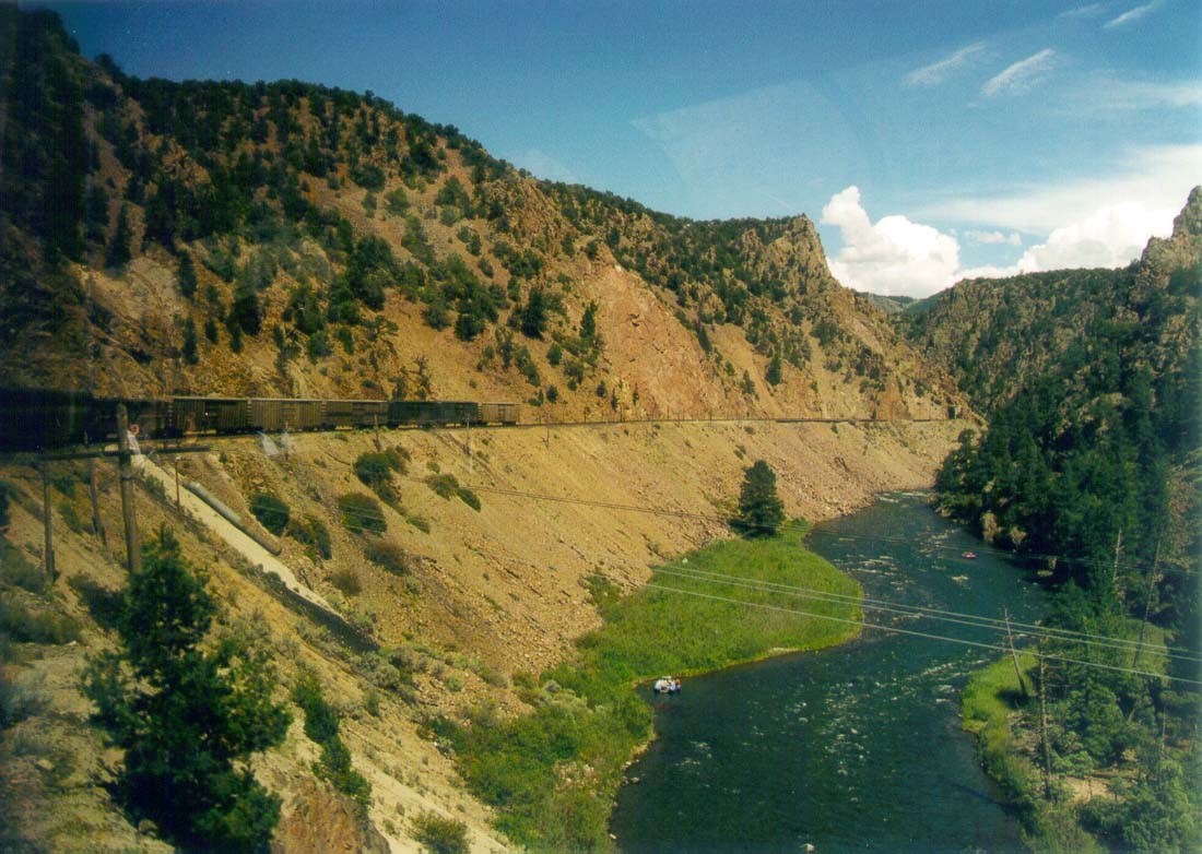
Here’s a westbound freight at Glenwood Springs on 11/08/1981. It’s led by GP40-2 No. 3103, GP40 No. 3052, and another GP40-2. My mother took this shot with some kind of instamatic camera. Here’s another view. | ||
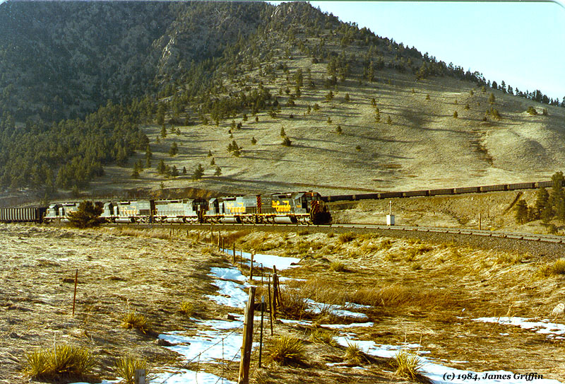 |
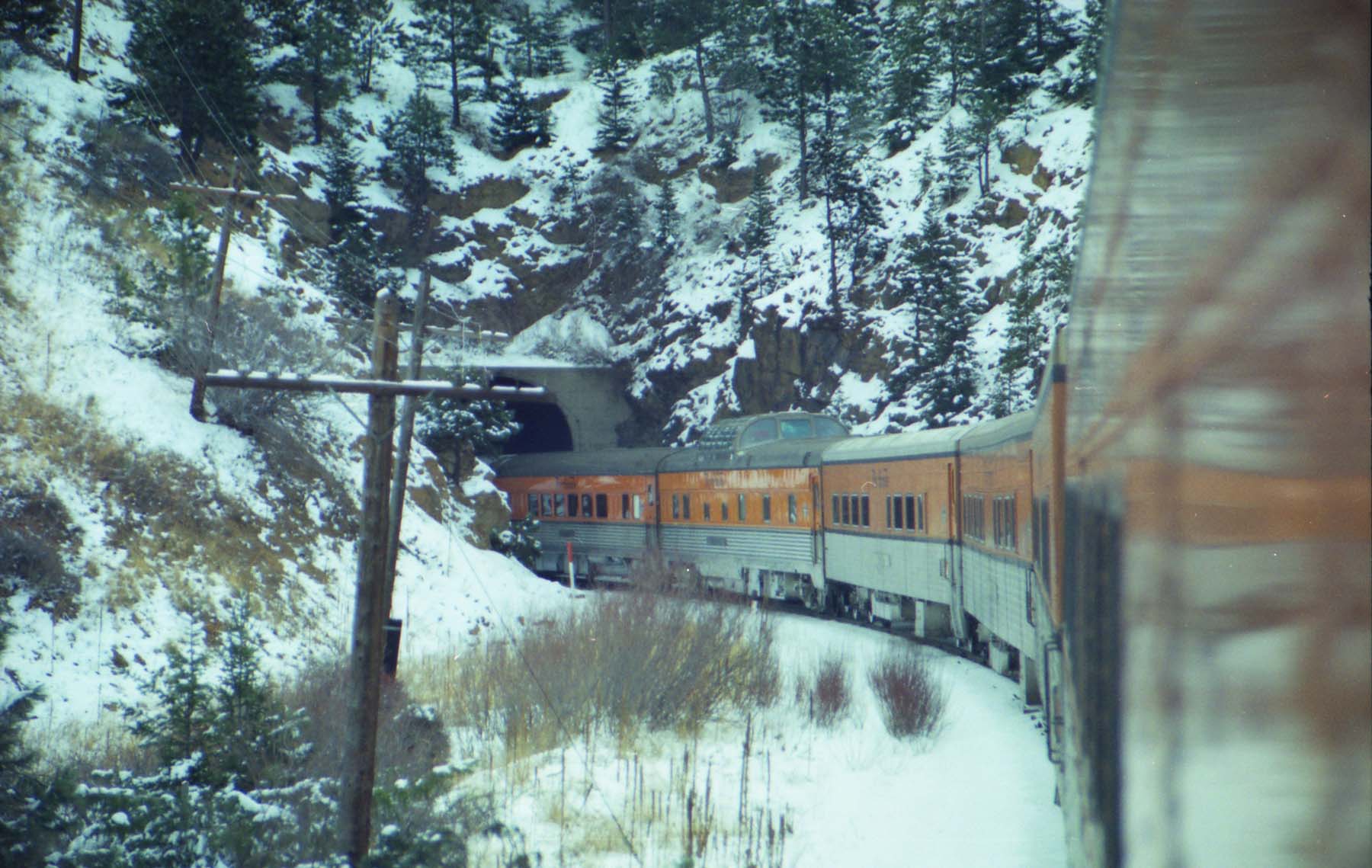
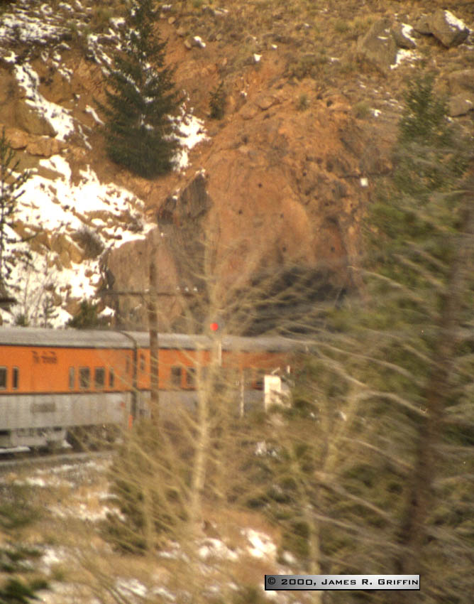
April 8th, 1984 finds an eastbound CSUX (Colorado Springs Department of Public Utilities) coal train descending from tunnel 1. This afternoon’s train has five units up front and another pair behind the caboose. This 73-car train (plus caboose) is trying to stay ahead of the returning Ski Train. I suspect it halted at Leyden to let the passenger train pass. | ||
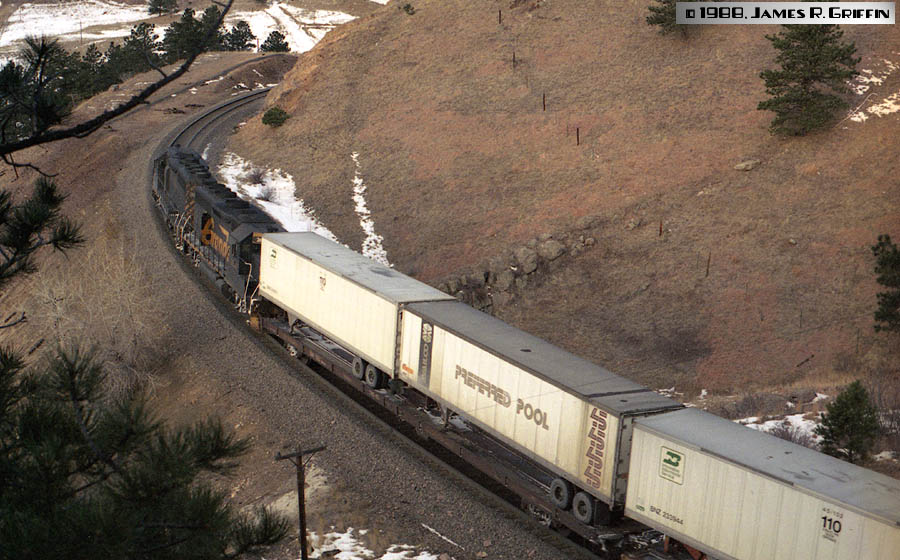 |
For the last years of its life, Rio Grande ran an interesting and somewhat famous little hotshot piggyback train between Salt Lake and Denver, overnight every night each direction. Here, on the morning of December 24, 1988, the eastbound movement is rolling out of tunnel 1 on the last leg into Denver. Nos. 3077 and 3116 are on the point (GP40, GP40-2). | ||
 |
On the same day as above and maybe a half-hour later, a westbound freight climbed the hill behind four Rio Grande 4-axle units, spliced by an SP tunnel motor. The two railroads had merged some three months prior, and SP units became increasingly common on Grande rails. Operationally, though, the DRGW scheme remained in place here (for the most part) until early 1992. | ||
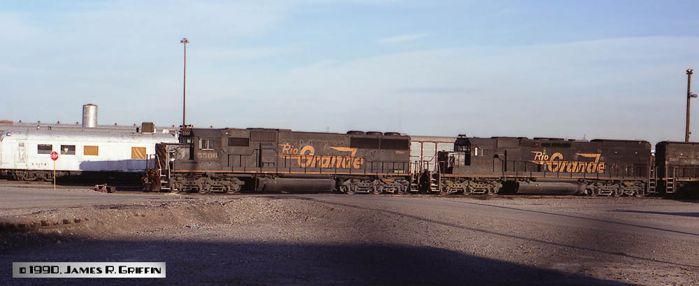 |
On November 20, 1990, a quick visit to North Yard showed off this string of D&RGW road power, spotted on a spur next to the crane track. SD50 No. 5506 and SD40T-2 No. 5348 (and what is probably 5401) are ready to go. In the background is the diner/kitchen/sleeper car X-3274, assigned to the Denver derrick train. | ||
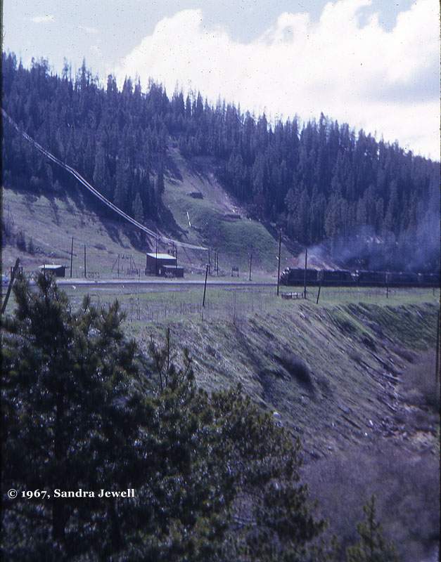 |
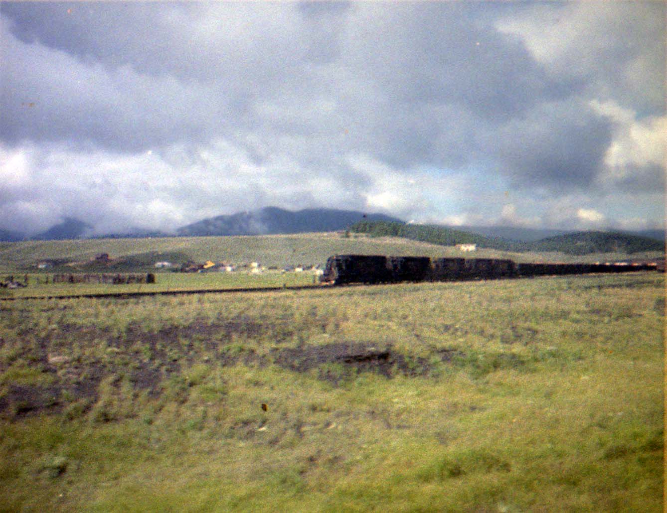
This view from the summer of 1967 shows a string of 4-axle units leading an eastbound train towards Moffat tunnel. There are at least two GP30s on the point. For those who are familiar with the contemporary surroundings, notice the total lack of ski condos in the shot. The valley was overall much more “natural” back then… | ||
Scenes and Sites: Bridges
|
|||
 |
The famous Hanging Bridge in the bottom of the Royal Gorge. It’s an innovative solution to a unique problem: how to carry the alignment through a stretch of canyon too narrow to carve a typical right-of-way? Answer: hang it over the river by anchoring girders in both cliff faces and suspend the bridge under it. | ||
 |
Here is a plate-girder bridge over the Arkansas river in the valley below Kobe. (August 2001) | ||
 |
Here’s an overhead truss bridge in the Arkansas Valley north of Buena Vista. (October 2018) | ||
 |
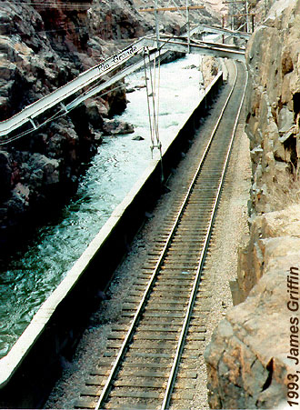
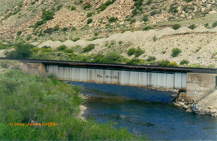
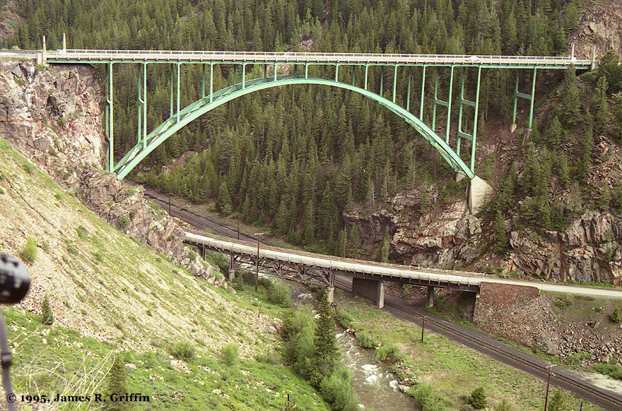
A short but familiar bridge to many, this is the one across the mouth of Coal Creek canyon. For many years it carried the Rio Grande sign shown here; around 1995 it was changed to a Southern Pacific meatball, and now it lacks any sign at all. | ||
 |
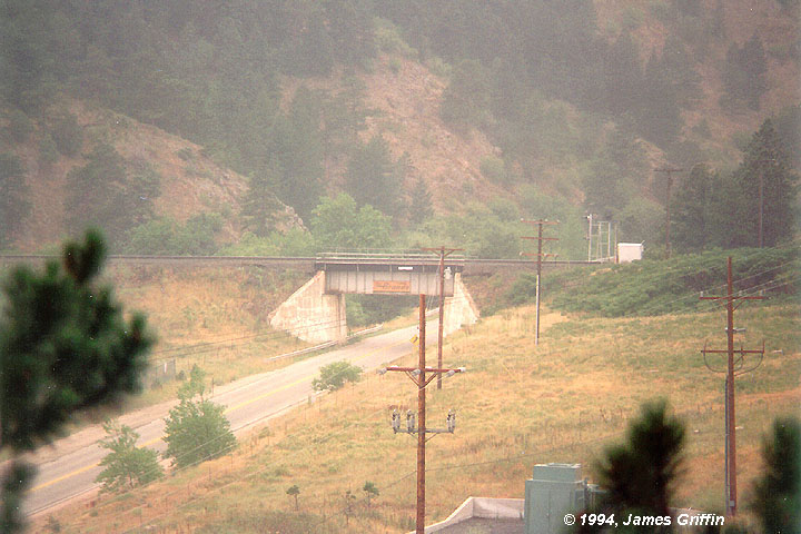
Many bridges! On the west side of Tennessee Pass is this spectacular exhibition of engineering: two highway bridges stacked over the railroad right-of-way. | ||
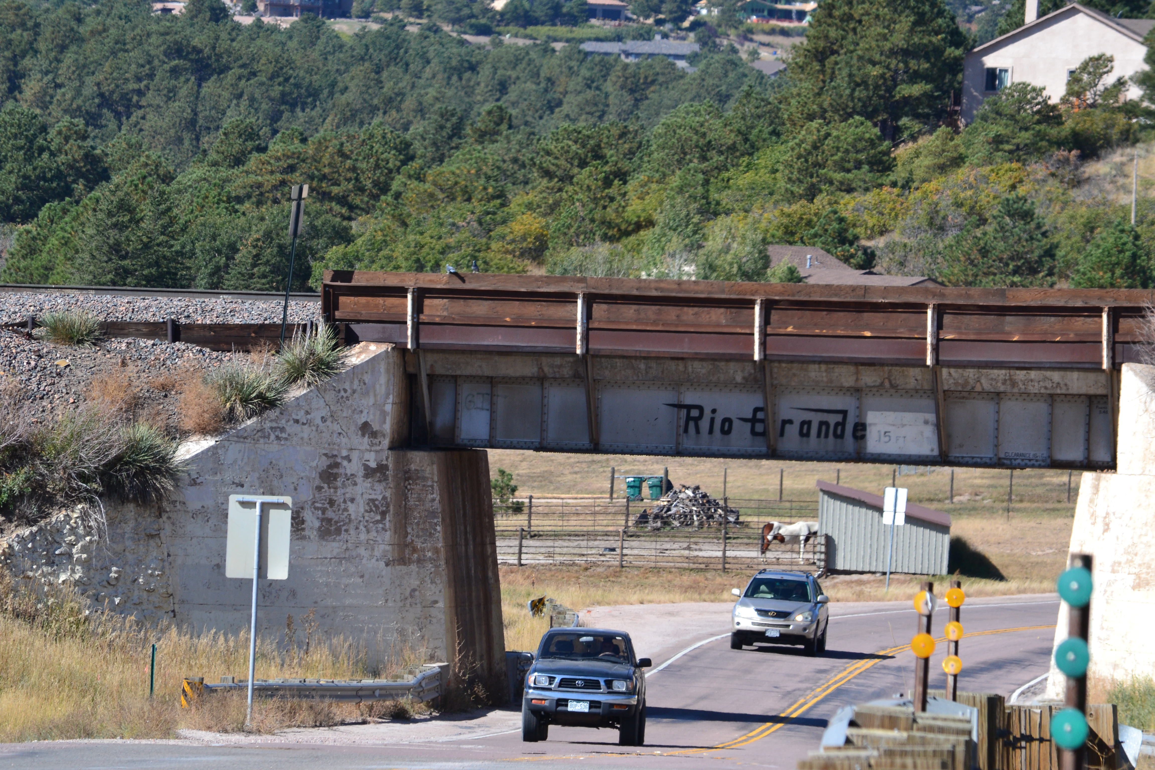  |
Bridge on the Joint Line, where the Rio Grande tracks cross Highway 105. Even though the photo is 31 years after the Rio Grande / Southern Pacific merger, the Rio Grande herald survives. (It’s UP track now.) Top: east facade.Bottom: West side, with the D&RGW Heritage Unit crossing atop it. In the year 2020 it was about the best Rio Grande photo a person could get. |
||
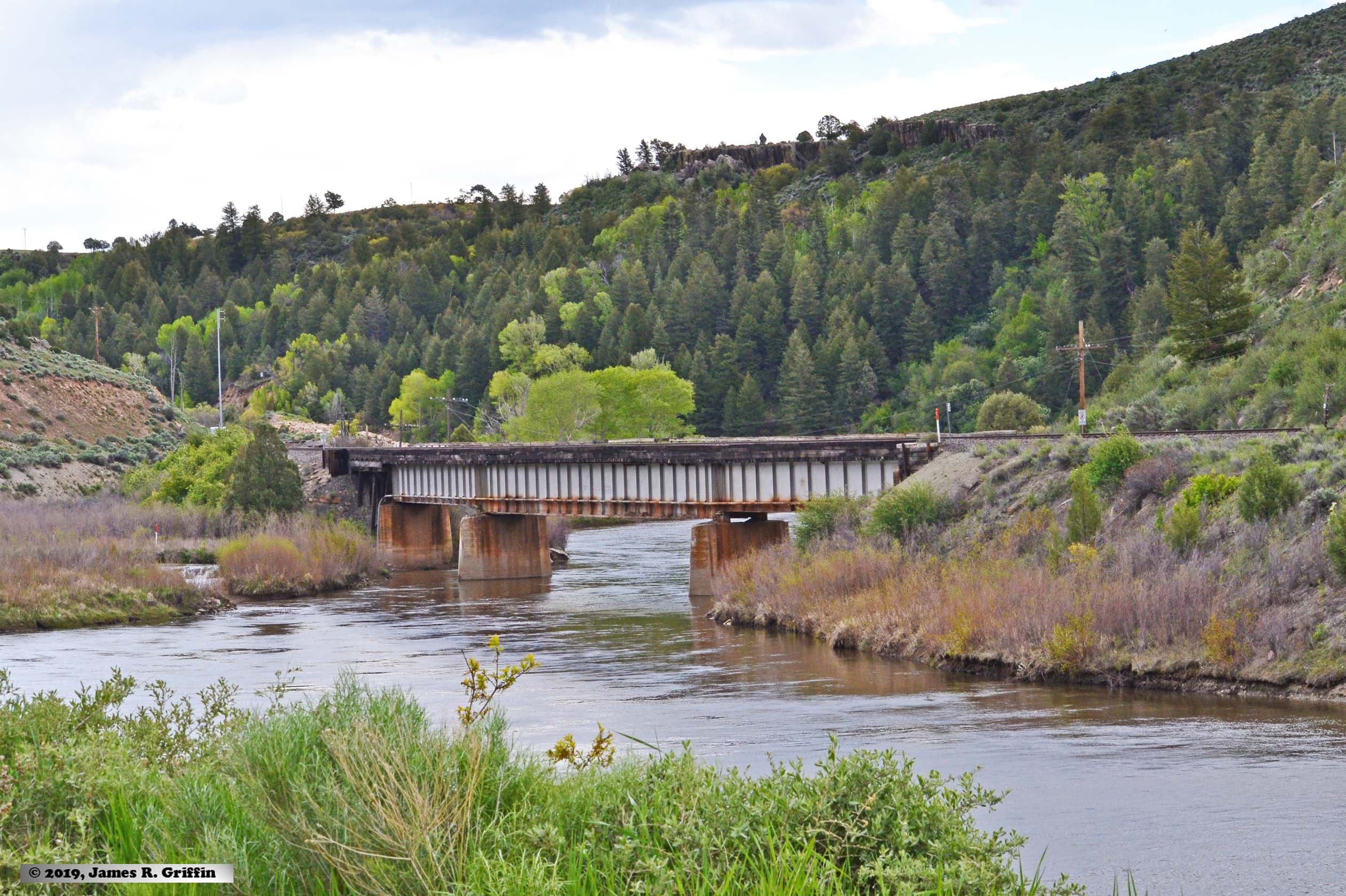 |
Deck bridge at Burns, Colorado– midway down the Dotsero Cutoff. View looking north-east. It’s a large image, and if you zoom in you can still see a faded flying Rio Grande herald on the center span. (5/31/2019)NEW IMAGE | ||
Scenes and Sites: Tunnels
|
|||
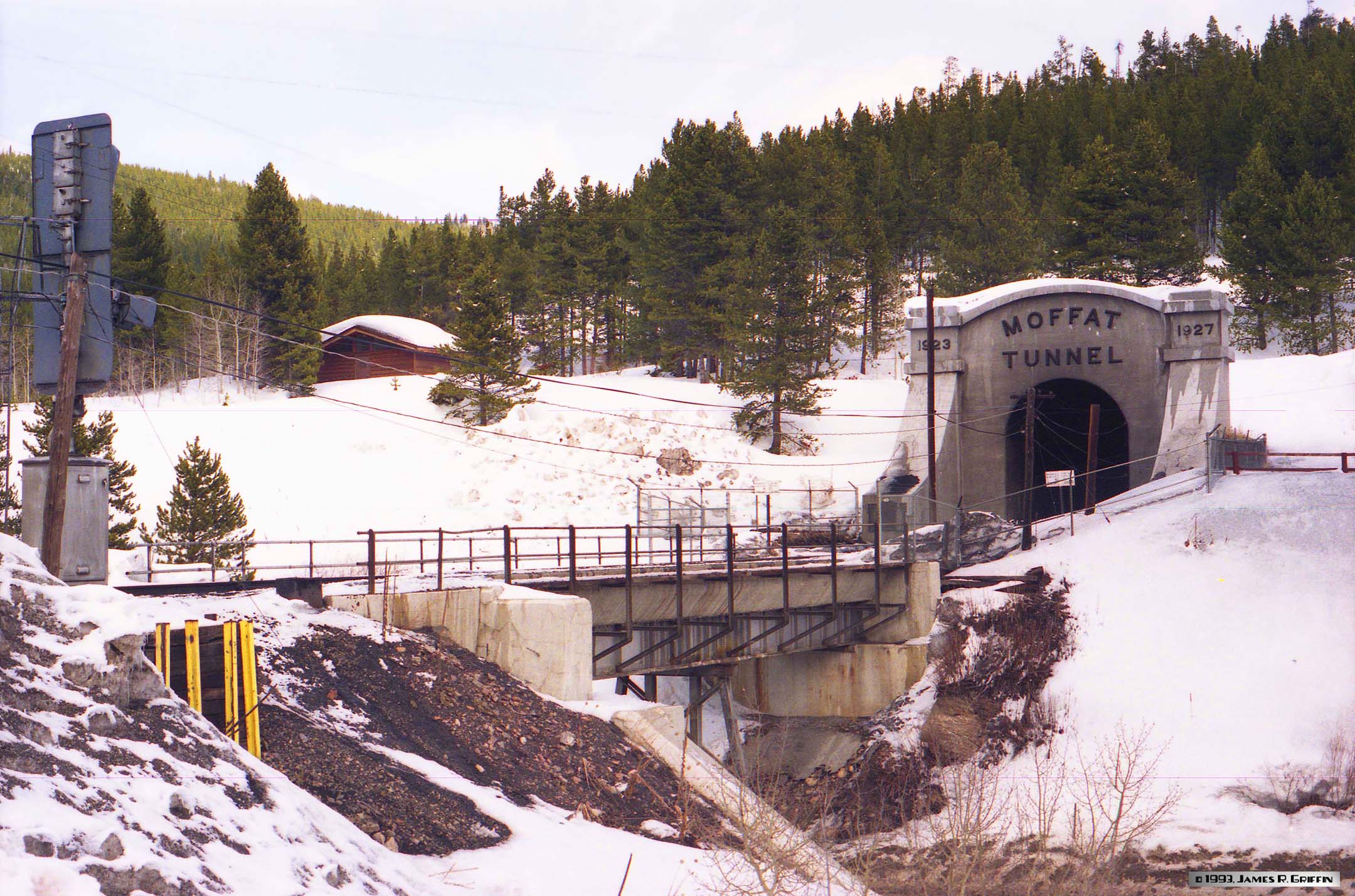 |
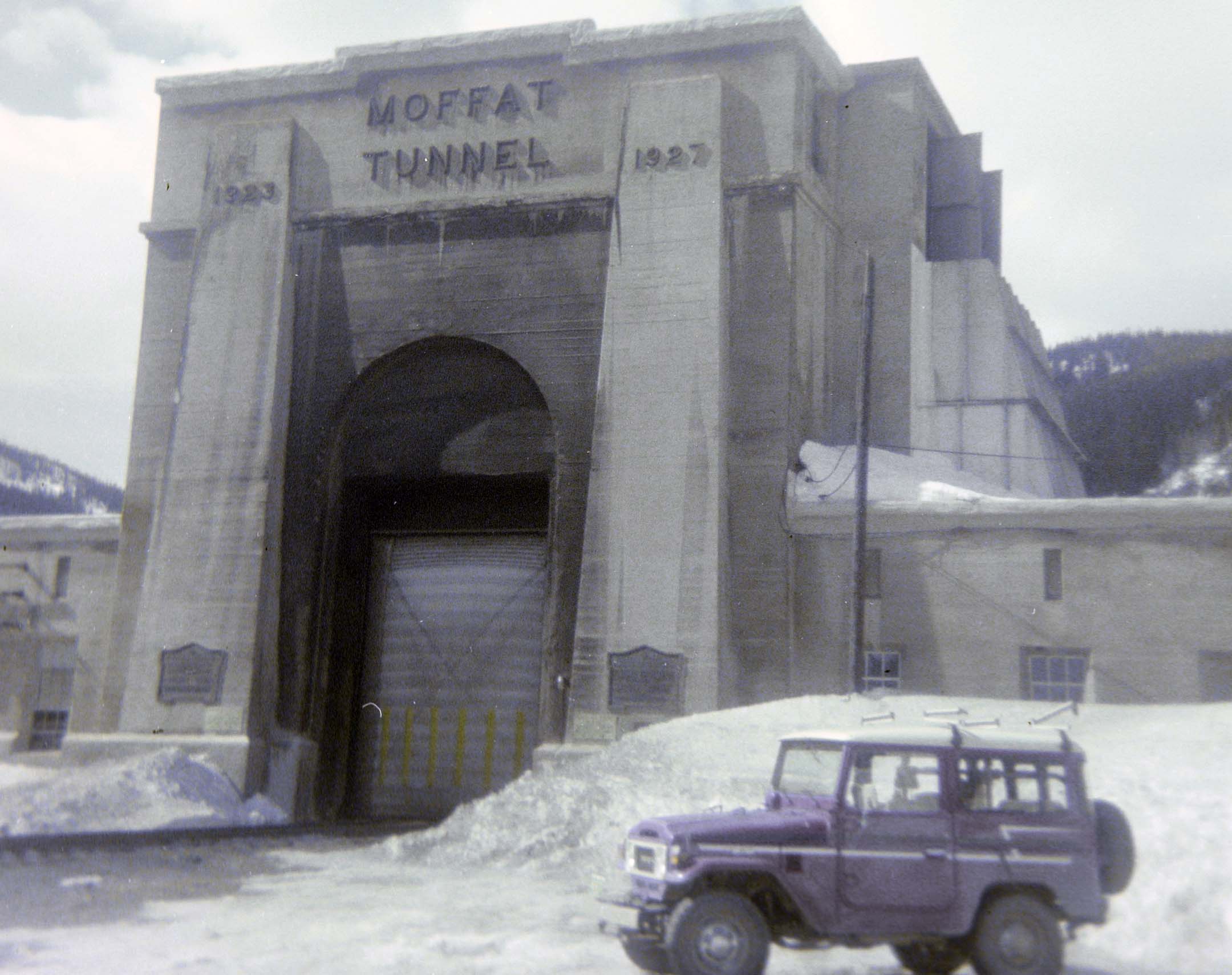
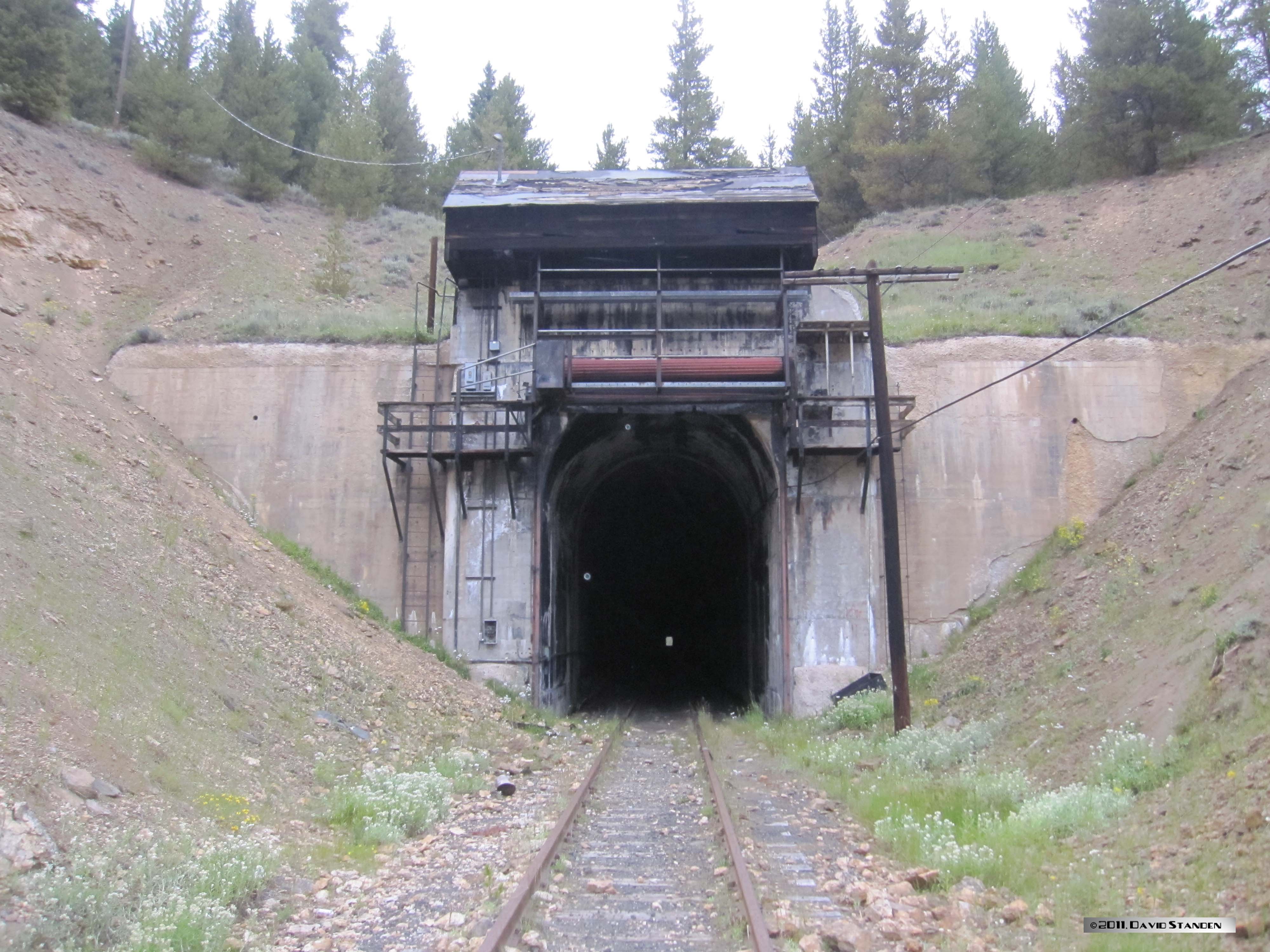
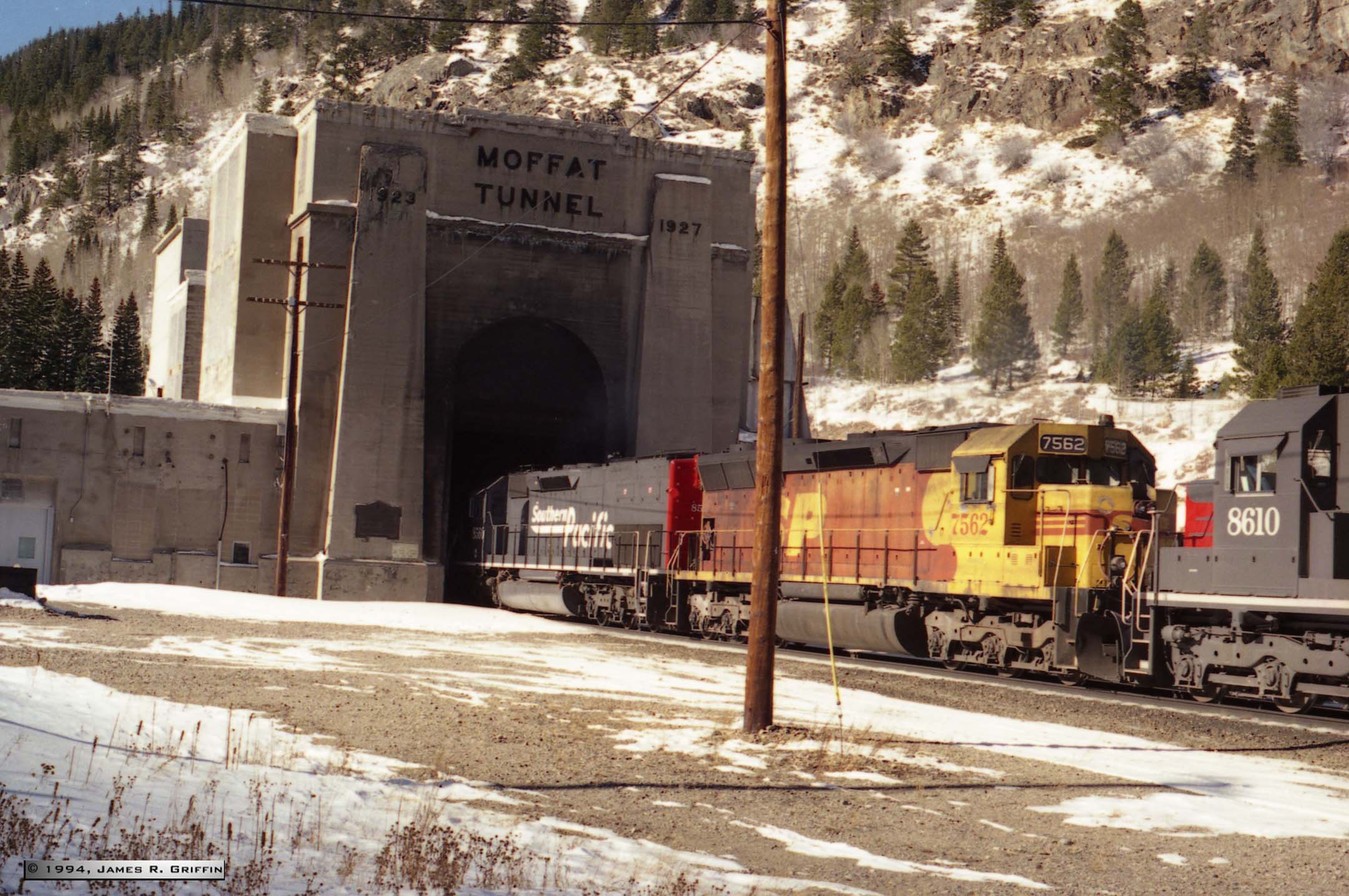
Bridge and tunnel: the west portal of the Moffat Tunnel as it appeared in 1993. The scene has changed considerably since then, with the addition of camera bridges and new service buildings, signal replacements, ski resort additions, etc. UPDATED IMAGE | ||
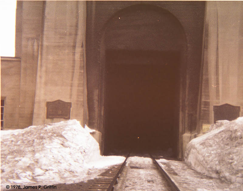  |
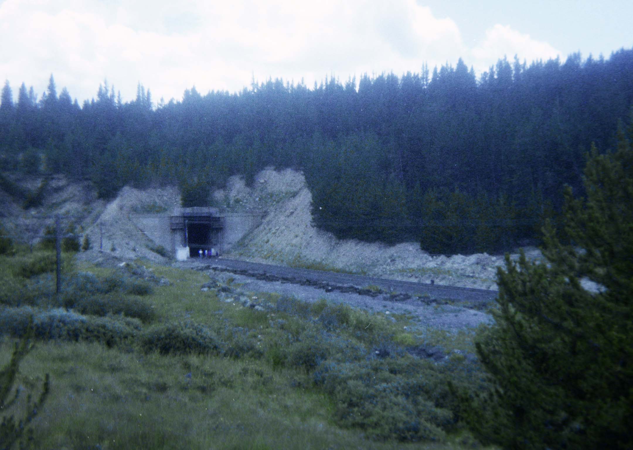
East portal of the Moffat Tunnel.TOP: March 1978. Here the curtain is up, and you can see the distant headlight of an approaching train. This is about 6 years prior to the rebuilding that modified everything here. Now you would never get away with standing there; far too much security. (Why I didn’t photograph the train when it came out is a mystery to me now.)BOTTOM: Circa February 1984, just prior to the fanhouse reconstruction. This shows the curtain as it appeared then. See here for a post-rebuild view in 1994.Notice how deep the snow sometimes gets in these two views. | ||
 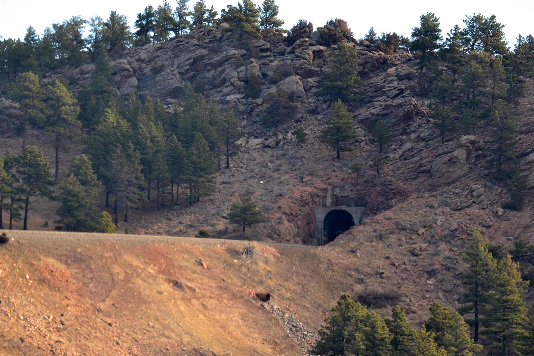  |
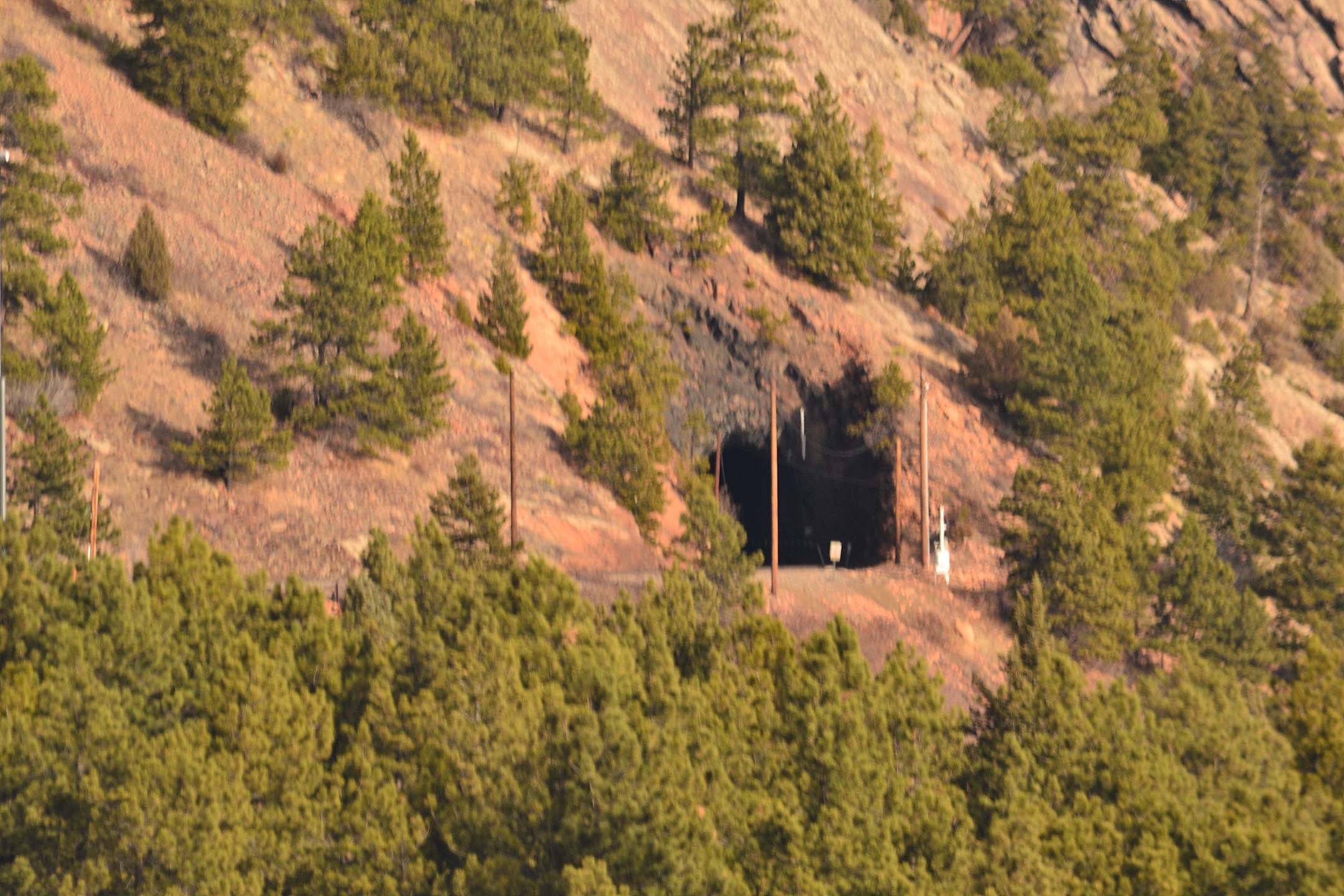
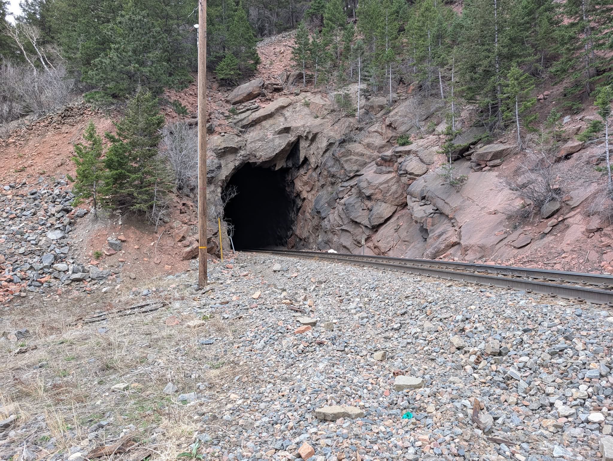
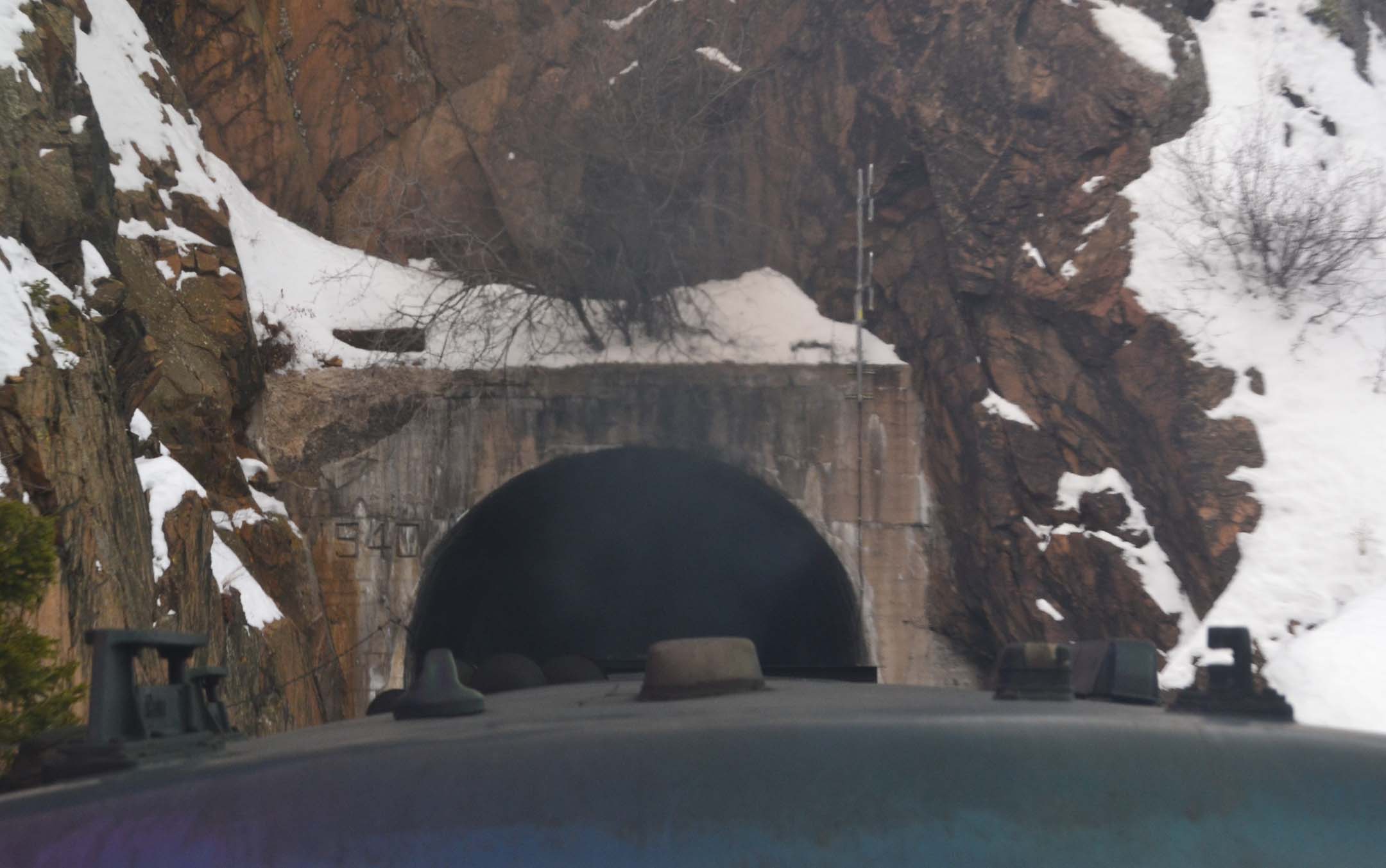
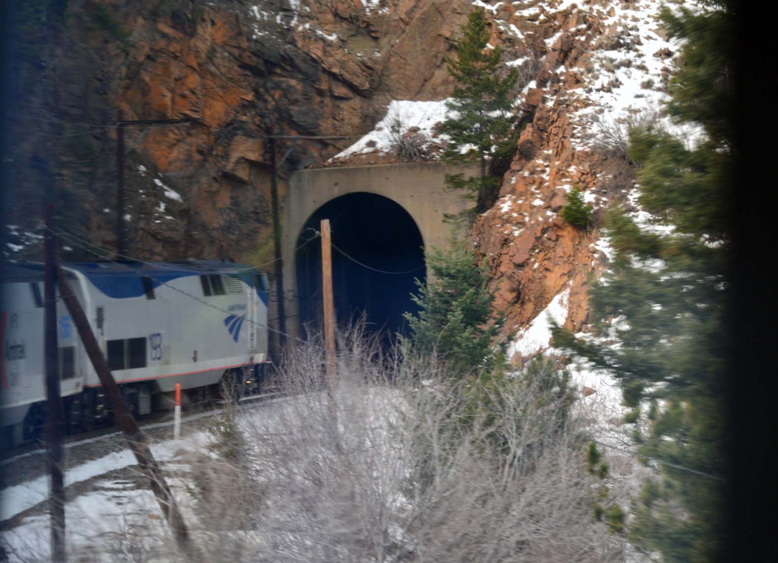
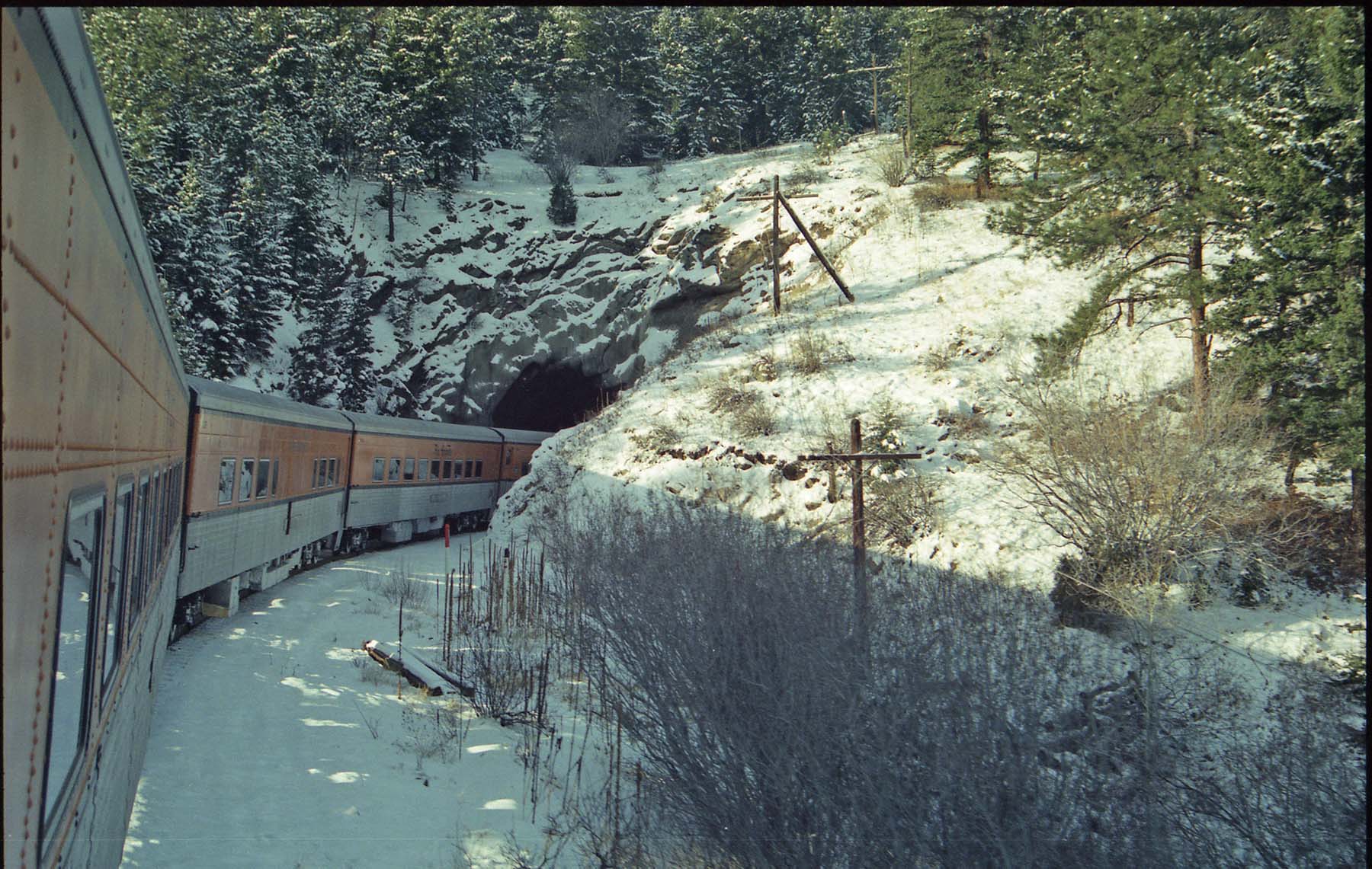
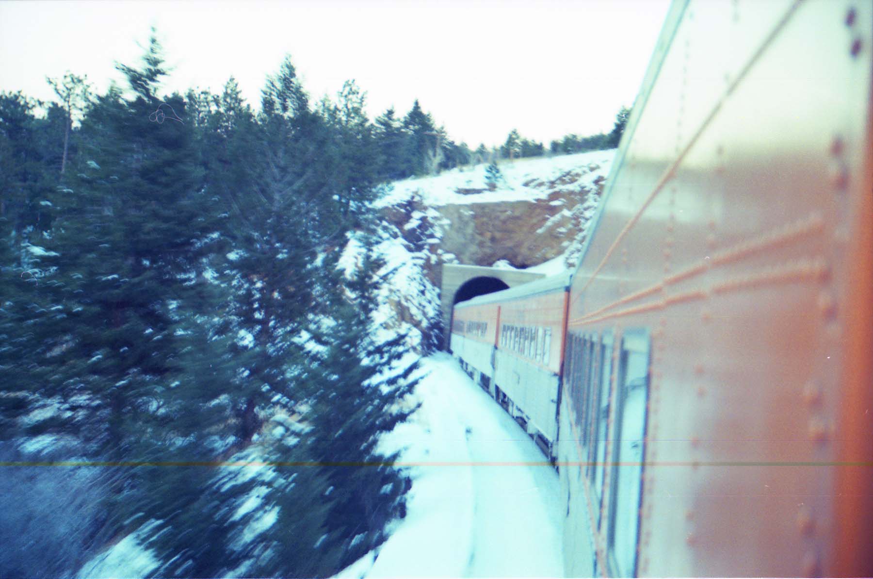
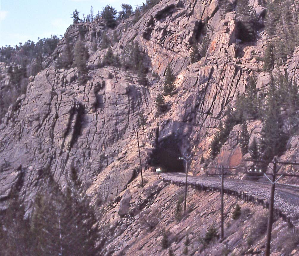
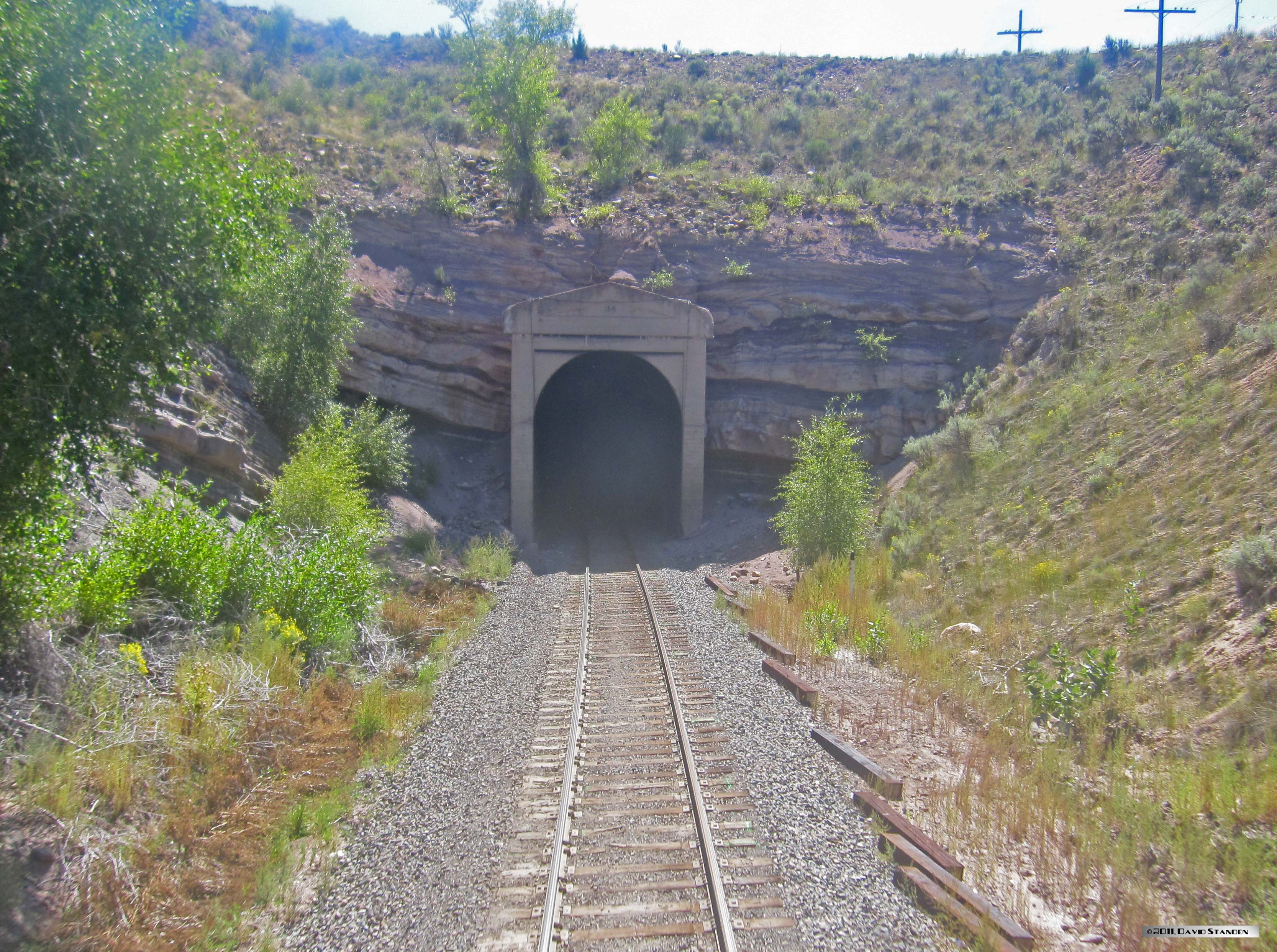
Here’s Tunnel 1, on the north side of Coal Creek Canyon. 299′
|
||
  |
Tunnel 2 (516′) Top: East portal. The track approaches along the shelf at left, then makes a hard left turn to dive through the hogback. This portal is stable and is just bare rock. From aboard the Winter Park Express, Feb. 2018 Bottom : the west (north) portal. Photo courtesy of Robert William Romaine. NEW IMAGE |
||
 |
This angle shows Tunnel 3 (369′) passing through a flatiron, plus Tunnel 4 (174′) at far right. You can really see the way the engineers laid out the alignment to penetrate these flatirons. | ||
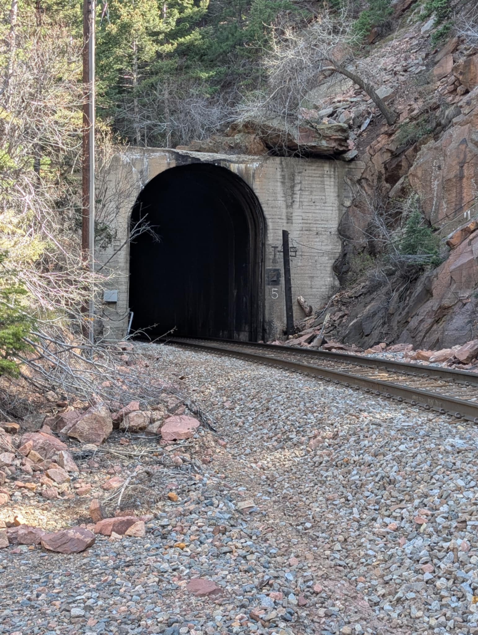 |
Tunnel 5 (636′), west portal. This utilitarian structure was installed here in 1942, one of the earlier ones built. Considering it was built around the rapidly-escalating traffic of World War 2, it is impressive that it got done at all. (Photo, Robert William Romaine) NEW IMAGE | ||
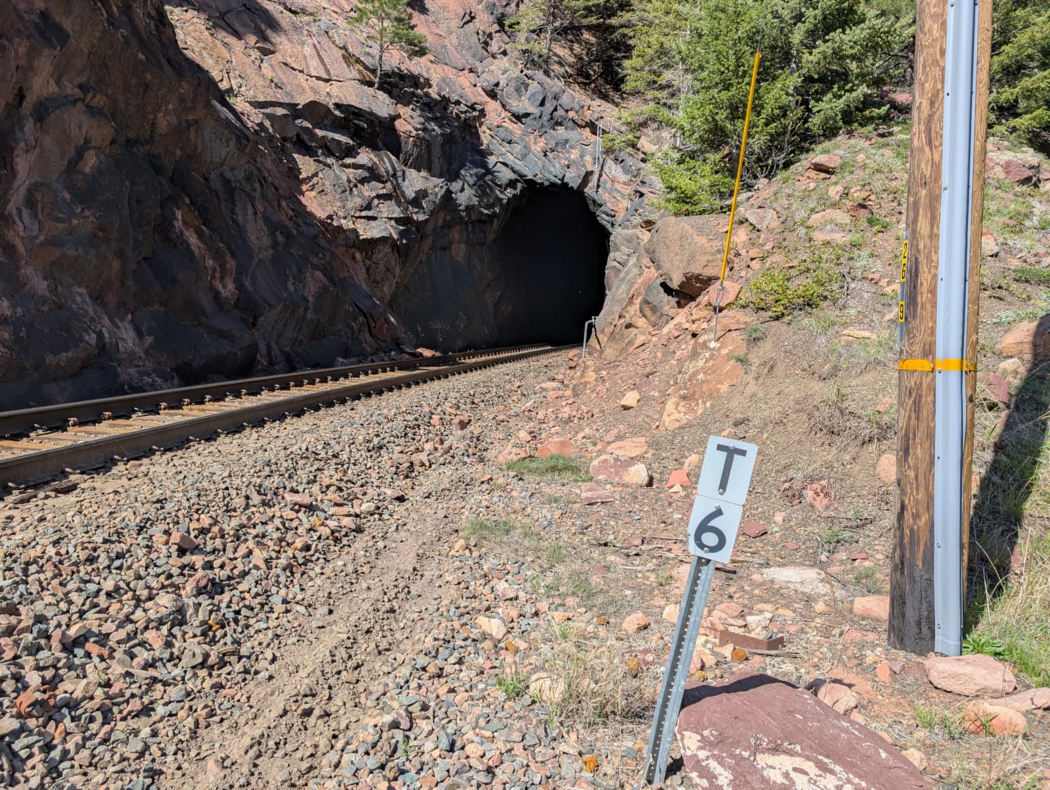 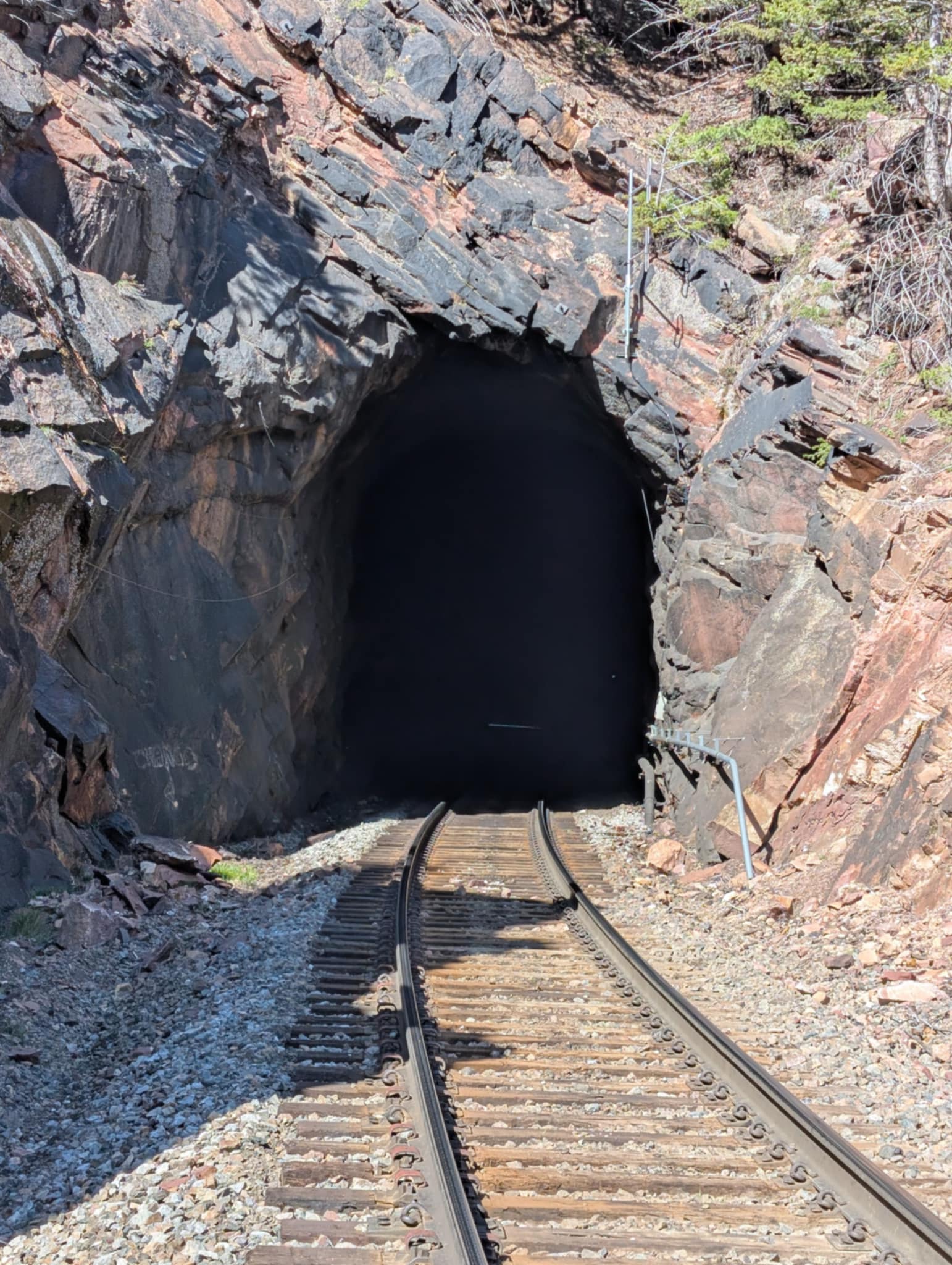 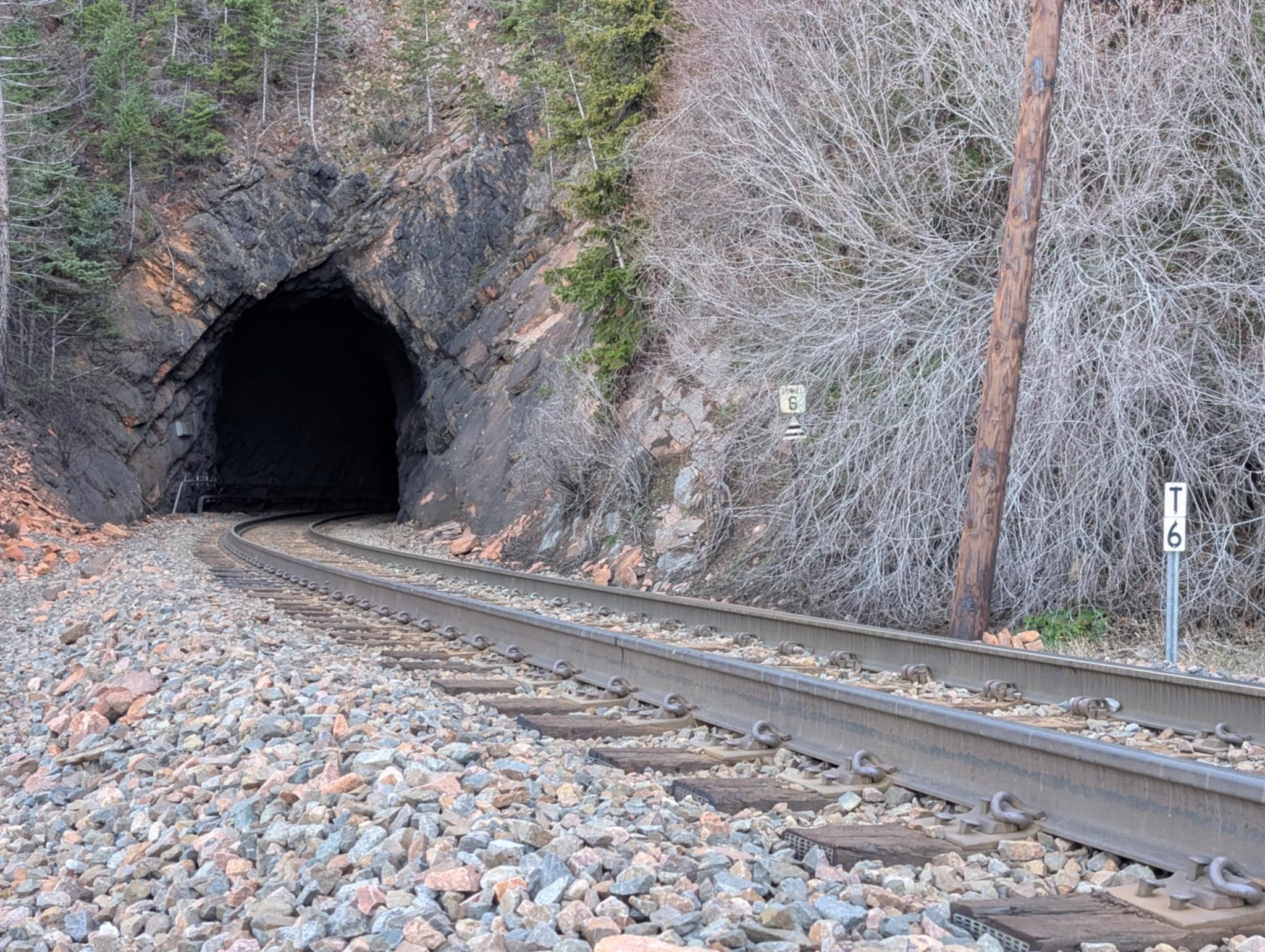 |
Tunnel 6 (536′)Top and Center: east portal, two views. Tunnel 6’s portals are stable enough to not require any portal facings. The raw entrances are a nice esthetic change from the usual concrete reinforced entrances.Bottom: west portal. Note the distinctive pointy ceiling at this end. (Three photos, Robert William Romaine) NEW IMAGES | ||
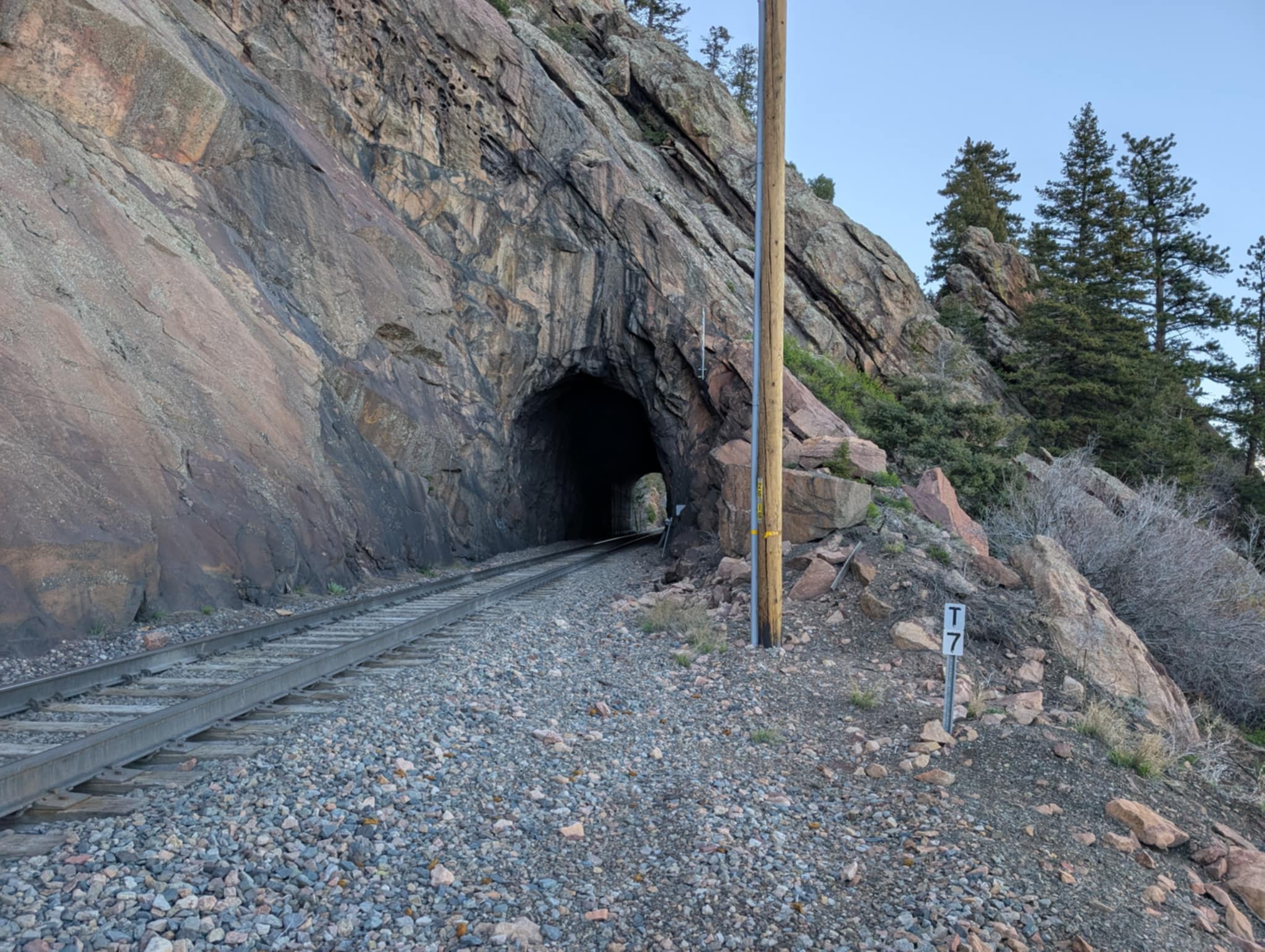 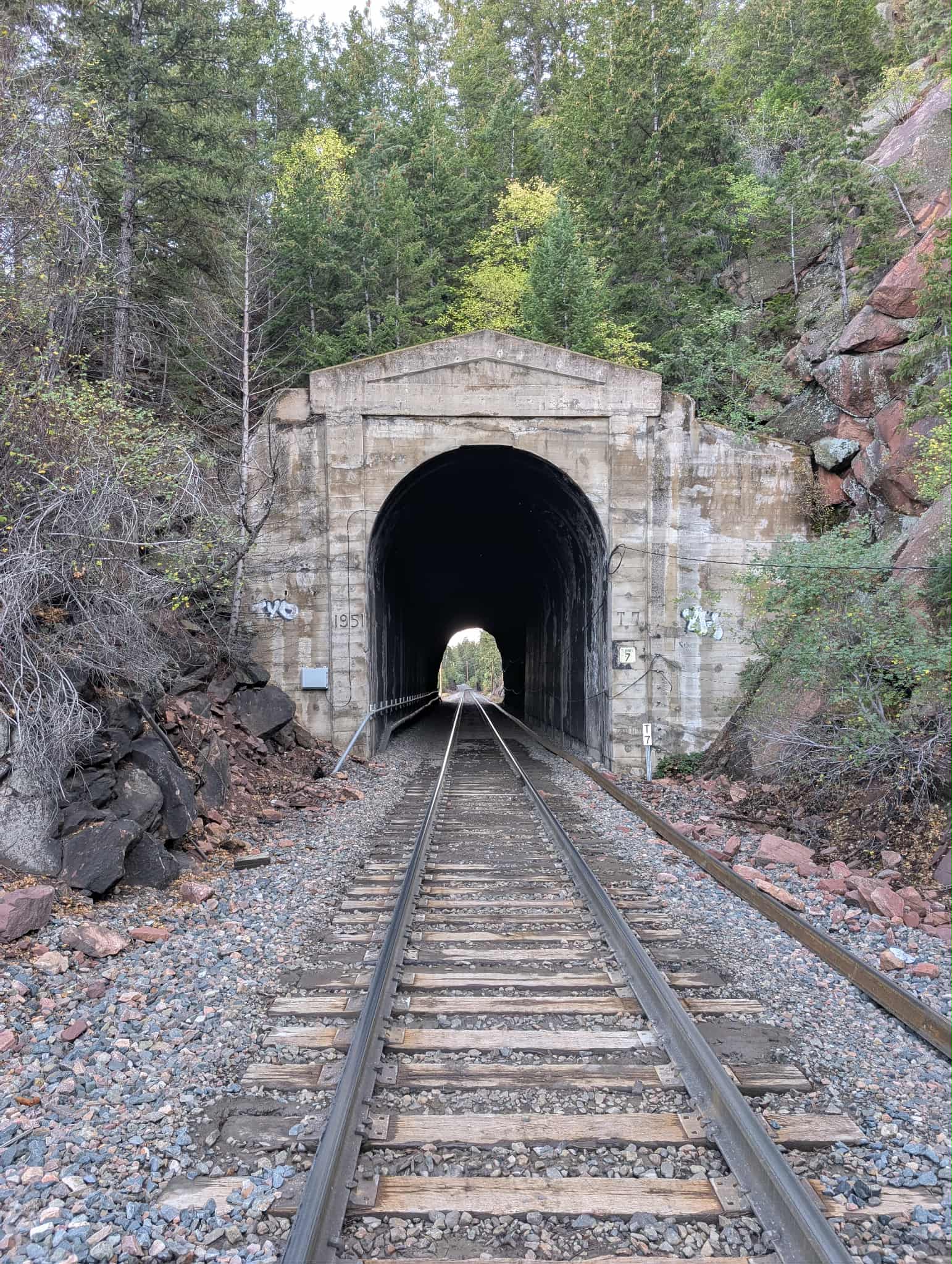 |
Tunnel 7 (208′)Top, east portal. Tunnel 7 is short and straight, well-supported by the flatiron it’s bored through.Bottom: west portal. This end is a bit more crumbly and a concrete facing was poured (with postwar decoration) in 1951.(Two photos, Robert William Romaine) NEW IMAGES | ||
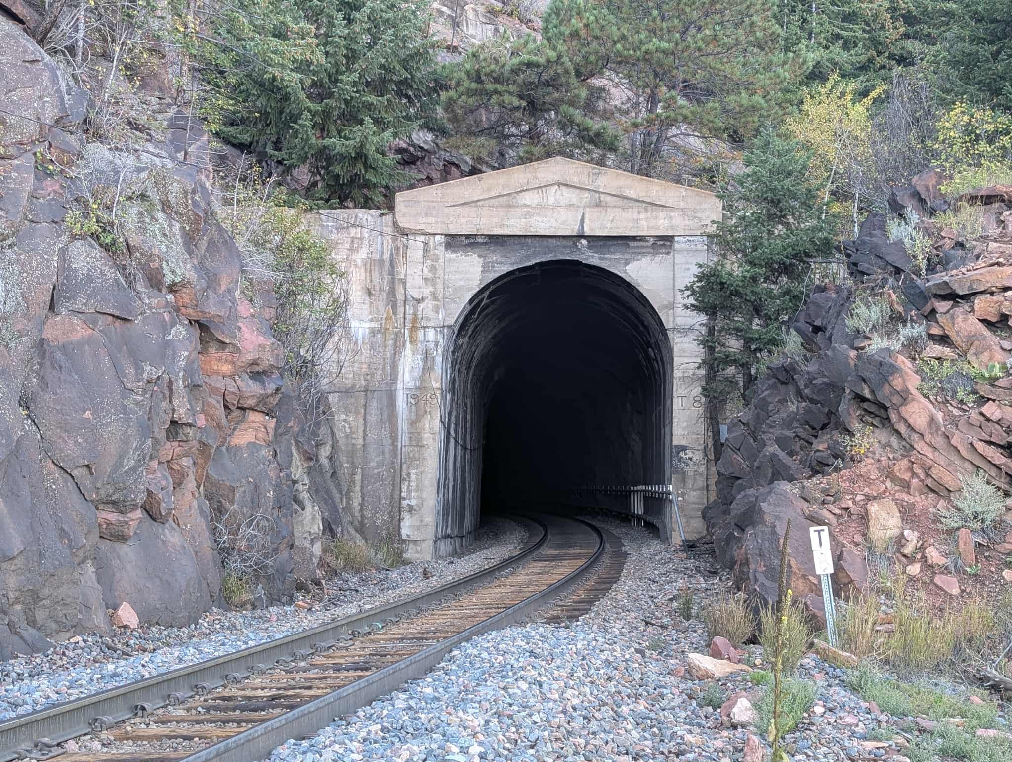 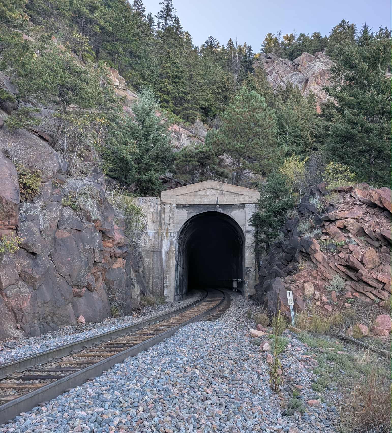  |
Tunnel 8 (753′)Top and Middle: East portal, two views. This facing was poured in 1949 and has the post-war style with peaked portal and embossed pilasters.(Two photos, Robert William Romaine) NEW IMAGES
Bottom: west portal. Since my angle doesn’t quite show the tunnel mouth– just a corner of the wing of the face– I’ve opted to show a wider view of why the tunnel was built in the first place. This view is looking nearly south. The location of Tunnel 9, daylighted during construction, is to the right. |
||
 |
Tunnel 11, east portal (238′). This is aboard the Winter Park Express, where I was able to see above the locomotives from the front window of our car. Unfortunately you can only see the top half of the portal facings. As the casting says, this portal was built in 1940. | ||
 |
East portal of Tunnel 13 (312′), in a section of the tunnel district densely populated with…tunnels, coming into South Draw. From aboard the Winter Park Express, Feb. 2018 | ||
 |
Tunnel 16 (698′), west portal. This tunnel is at the top of the horseshoe where the line loops into South Gulch (behind the scarp of the Front Range). January 29, 2000, aboard the Ski Train. |
||
 |
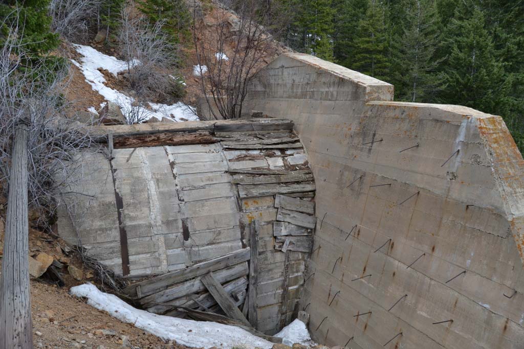
“Old” Tunnel 17 NEW IMAGE This is the site where the original Tunnel 17 was planned. During construction the geology proved too unstable to hold the structure, and the tunnel was bypassed with a “temporary” shoo-fly track that went around the ridge. That right-of-way is visible just to the right of the locomotives here. It remained in use until 1938 when the ridge over the crumbled tunnel was removed and the present alignment was restored per the original plan– minus the tunnel, of course. The number 17 was given to the next tunnel to the west. (12/28/1997) I find it interesting that the exact same situation occurred at tunnel 9, but that location retained the original number despite the lack of a tunnel. |
||
  |
Tunnel 19 (1,055′).Top: the east portal. The westbound Ski Train is rolling into the tunnel on 1/29/2000. Note the natural rock portal on this end.Bottom: the west portal. As with most tunnels in the tunnel district, it has significant curvature. (April 12th, 2014.) | ||
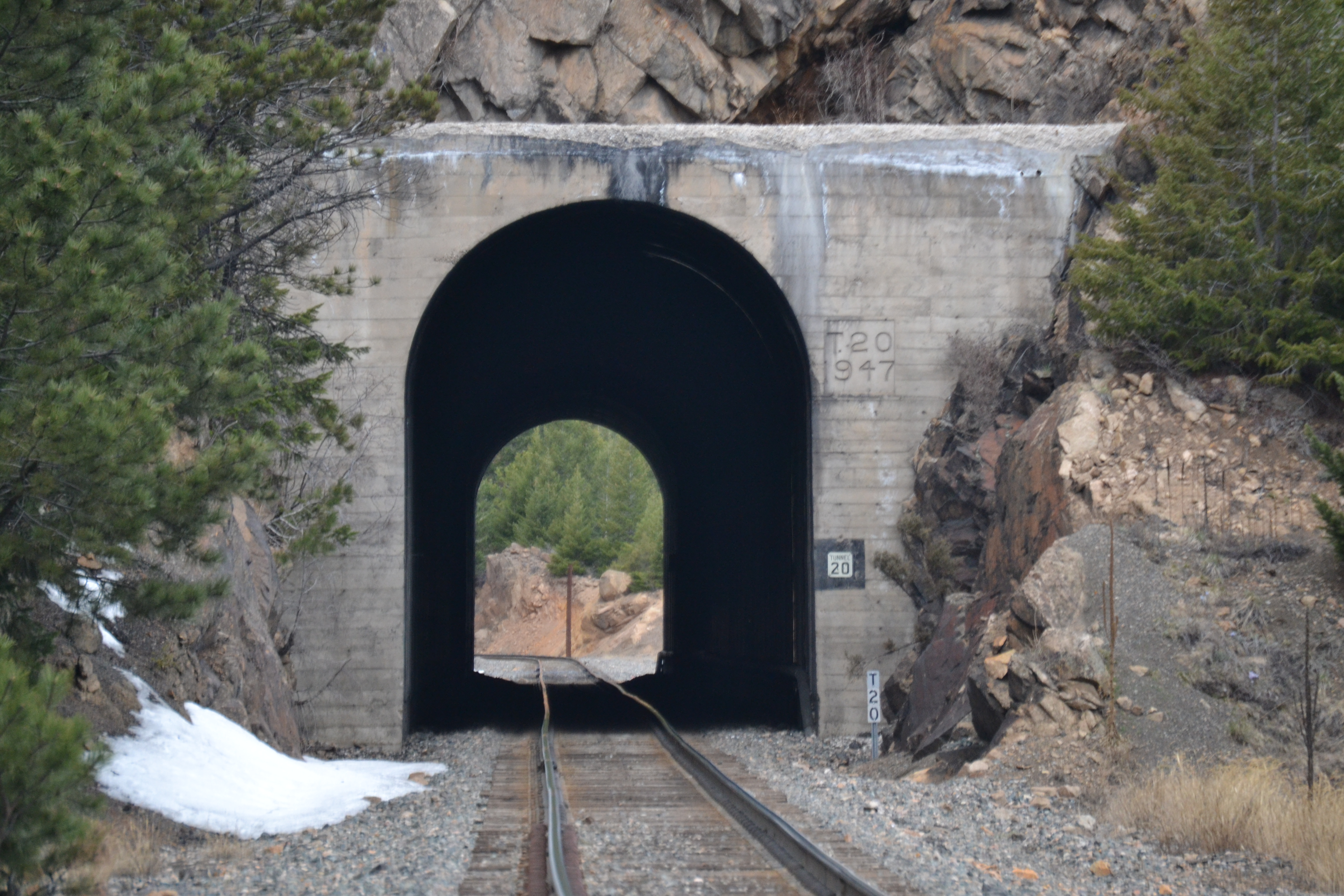  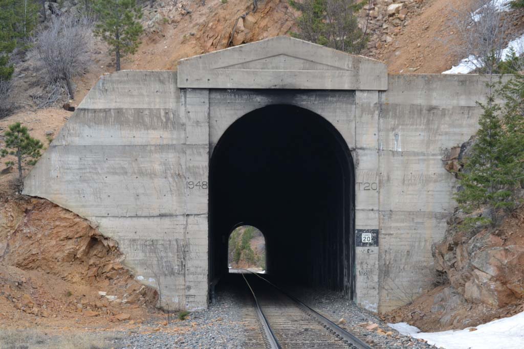 |
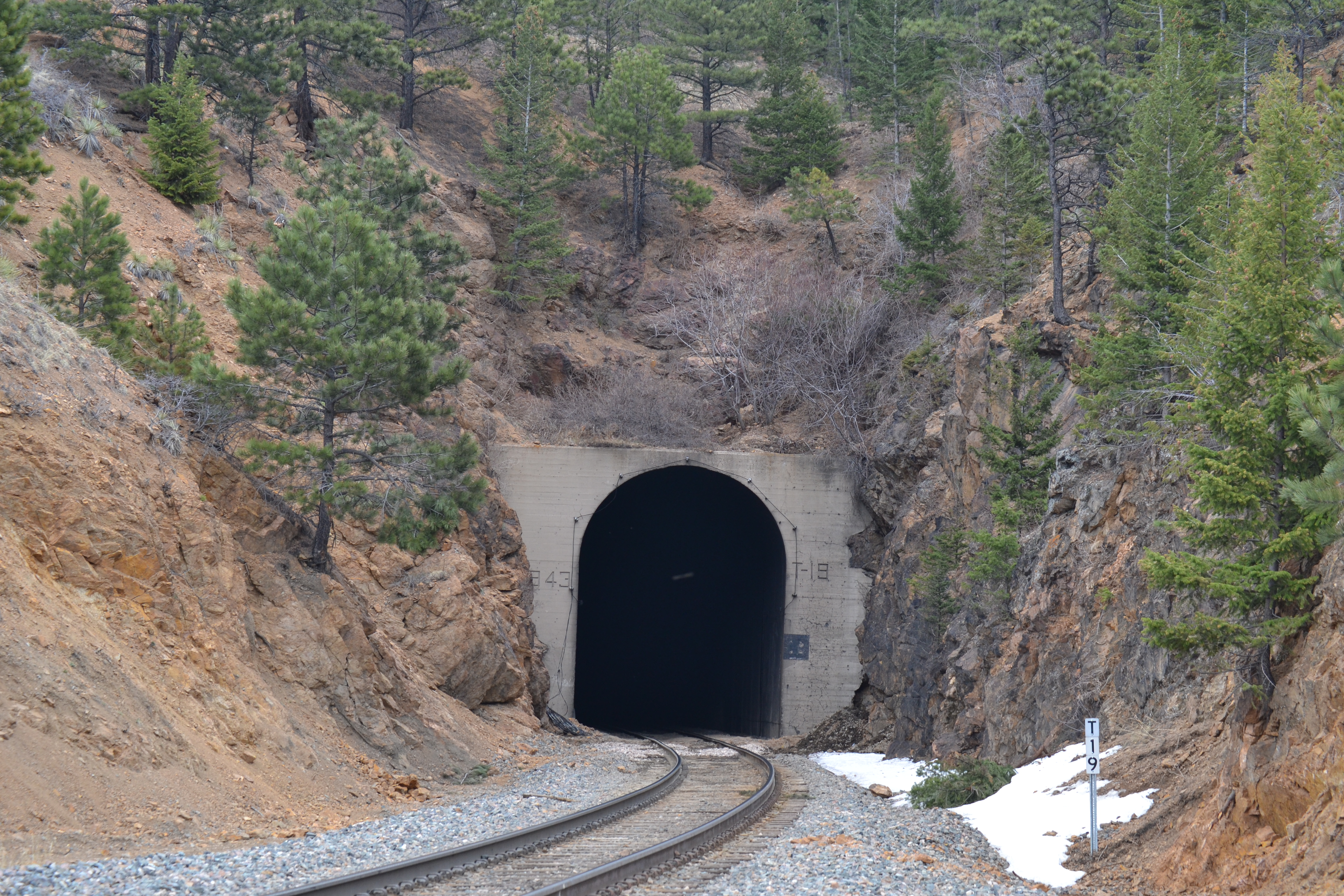
Tunnel 20. (460′)Top: east portal. As one of the few tunnels you can see through, it’s popular with railfanographers. The portal work was performed in 1947 on the east portal.Tunnel 20, west portal. Middle: the back side of the west portal. You can see how the railroad never even removed the forms built to pour the concrete.Bottom: the west portal. The portal work was performed in 1948 here on the west end.(April 12, 2014) |
||
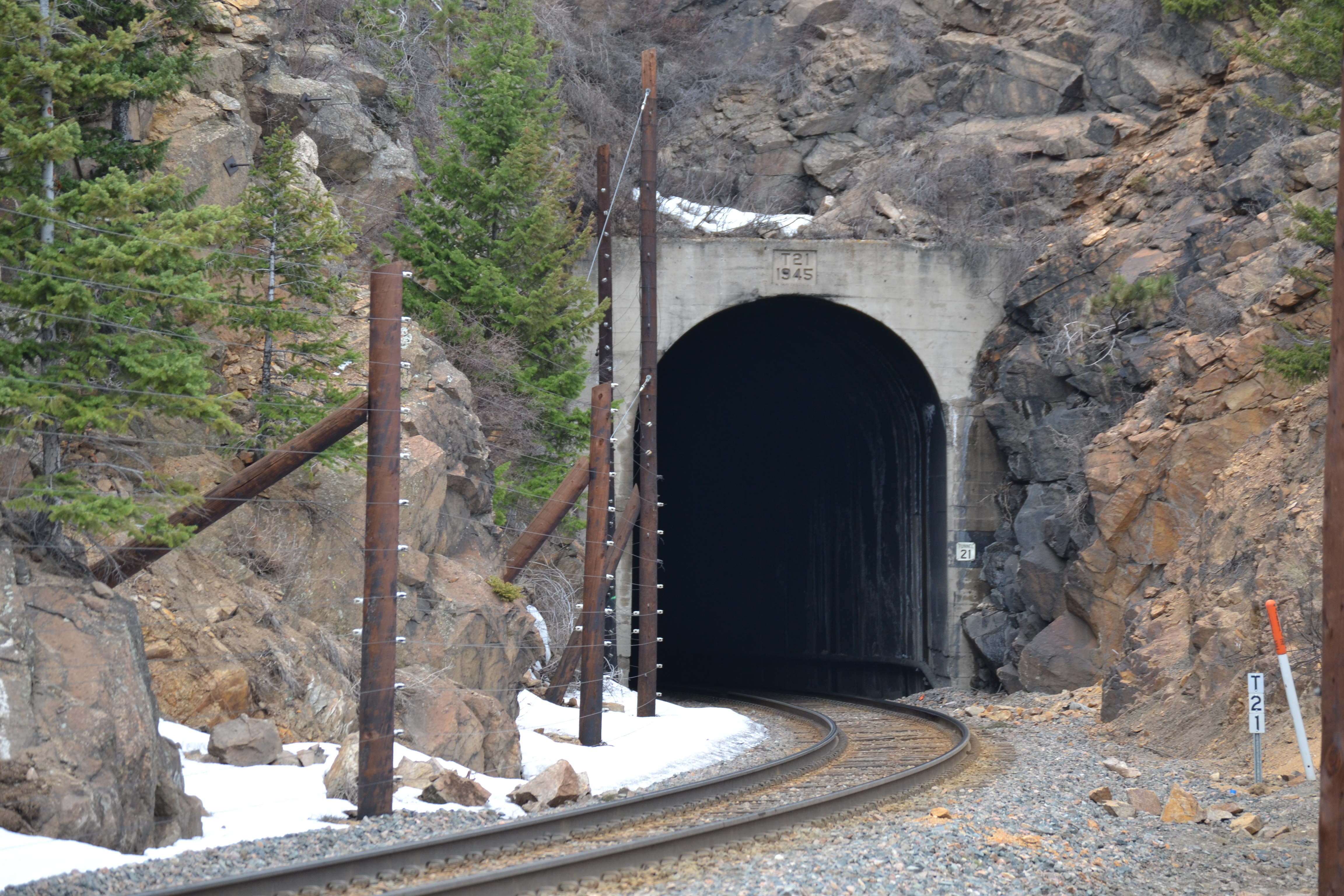 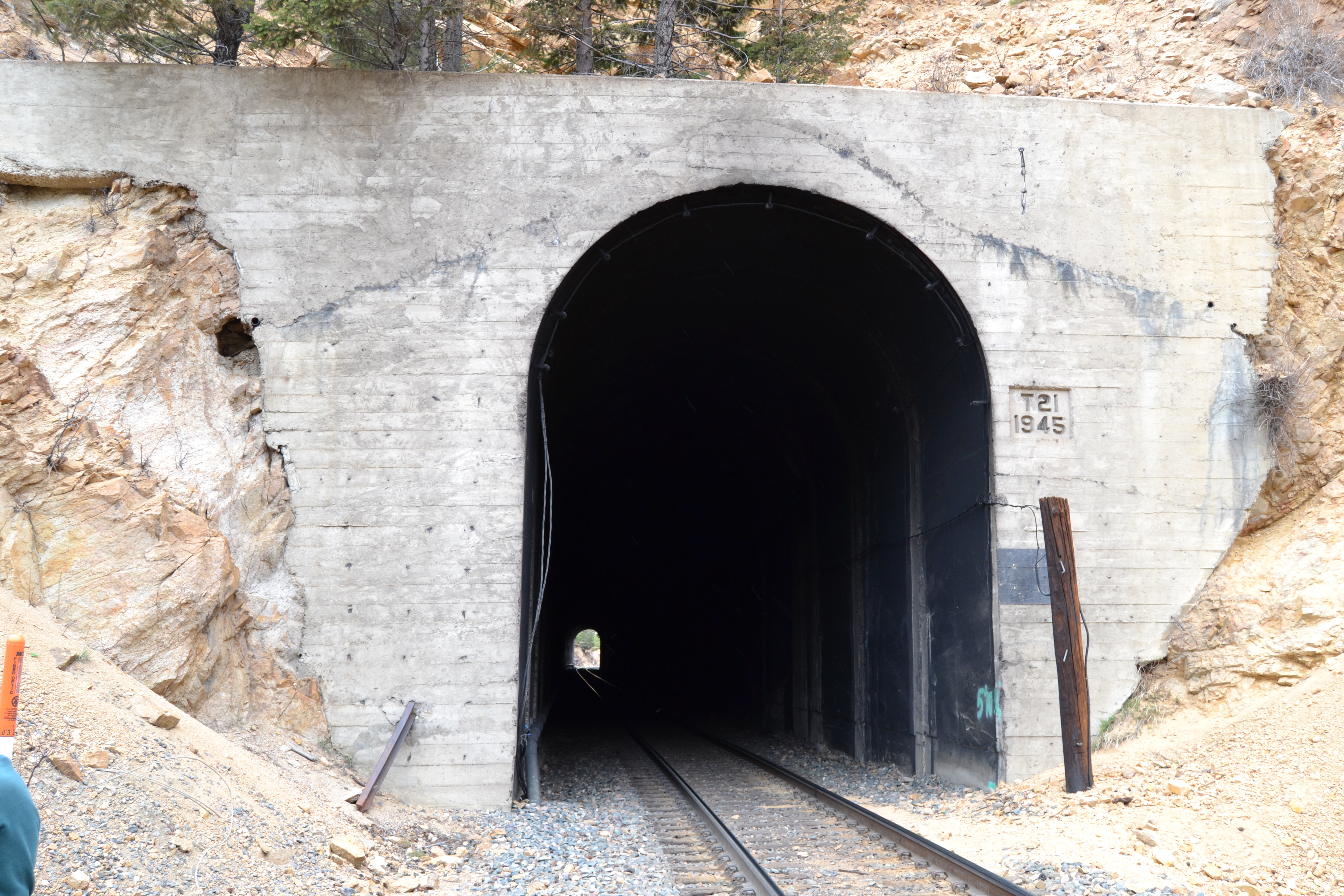 |
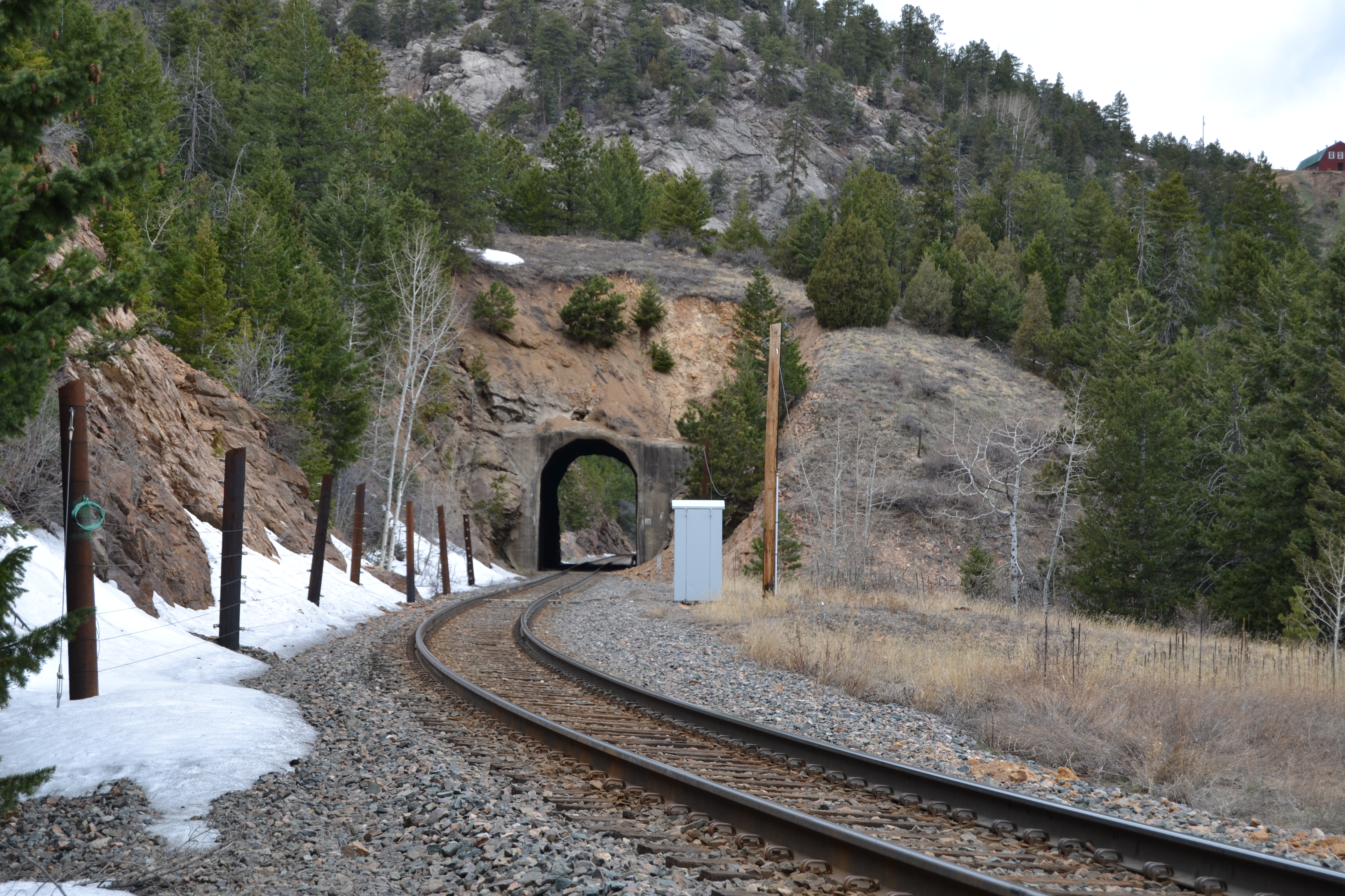
Tunnel 21 (667′) Top: Here’s the east end. The curve continues into the tunnel a short distance, but you can actually see through it if you stand in the right (wrong?) place. Note the slide-detection fence. This portal facing was poured in 1945. Bottom: the west portal. Note that you can see through it, but the curve at the far end eclipses part of the arch. |
||
  |
Tunnel 22 (180′), one of the other exceptions that can been seen through. It penetrates a low ridge and is only about 200 feet long. Incidentally, the next tunnel (23) passes nearly directly beneath that barn high on the next ridge.Top: the east portal.Bottom: the west portal, as seen from the Ski Train (1/29/2000) | ||
 |
Tunnel 24 (812′), the east portal, seen from the Ski Train on 12/28/2000. Note the intermediate block signal, partially obscured by the trees. The signal has since been moved by UP. NEW IMAGE |
||
 |
Tunnel 27 (643′), the west portal. Look carefully and you’ll see that the track begins a hook to the right just before entering the tunnel, which continues that curve. Ken Albrecht photo. (5/20/1981) | ||
 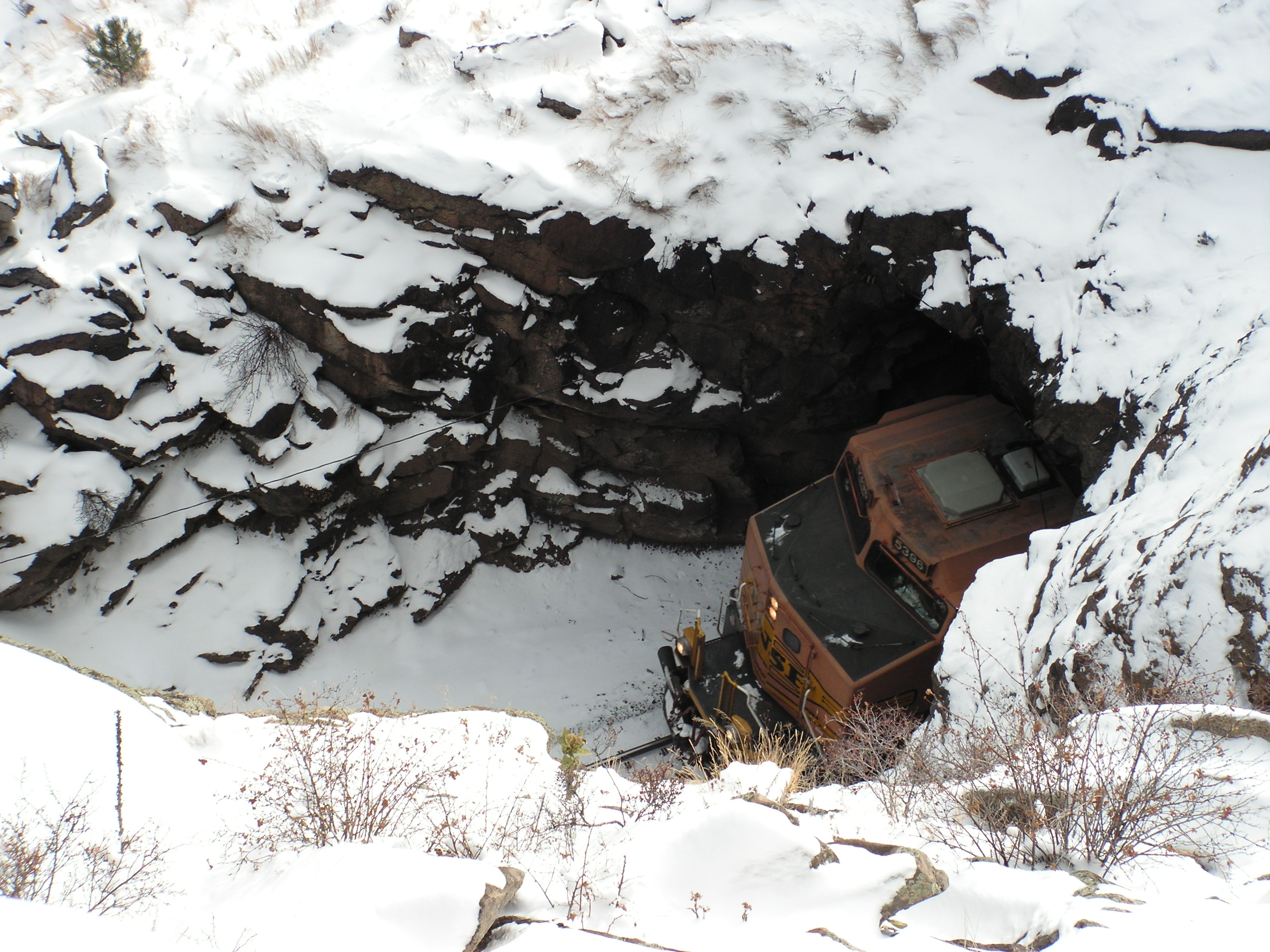 |
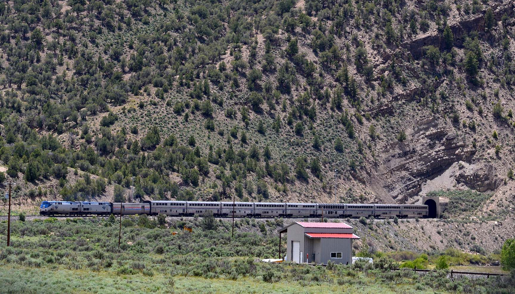
Ultra-short Tunnel 29 (78 feet). It doesn’t even get dark inside when you pass through. Top: This is the east portal, from November 1994 as the swing helpers on a loaded PSCX coal train pass through. UPDATED IMAGEBottom: West end. This is a fun perspective, looking down at the track as a westbound BNSF train emerges. Scrambling around on a snowy cliffside 75 feet above the track is, shall we say, exhilarating. (December 2008) |
||
| Tunnels 31, 32, and 33 were located on Rollins Pass and were abandoned after the Moffat Tunnel was built. Tunnel 34 is in Fraser Canyon and, like many of these tunnels, has no non-rail access. | |||
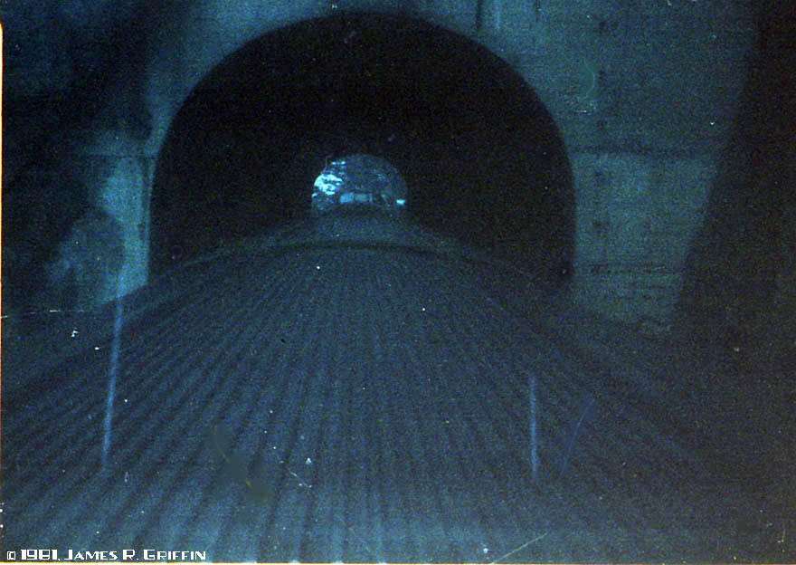 |
From aboard the Rio Grande Zephyr– the east portal of tunnel 35. I apologize for the image quality; I only had a 110 camera at the time and the day was extremely gloomy; shooting through tinted glass only compounded the problems (same with the image below). However, one can’t exactly go back and re-do these shots now!(11/07/1981) | ||
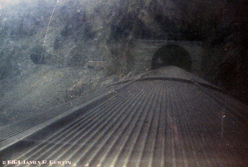 |
From aboard the Rio Grande Zephyr– the east portal of tunnel 36. Tunnel 37 is visible ahead of the power. (11/07/1981) | ||
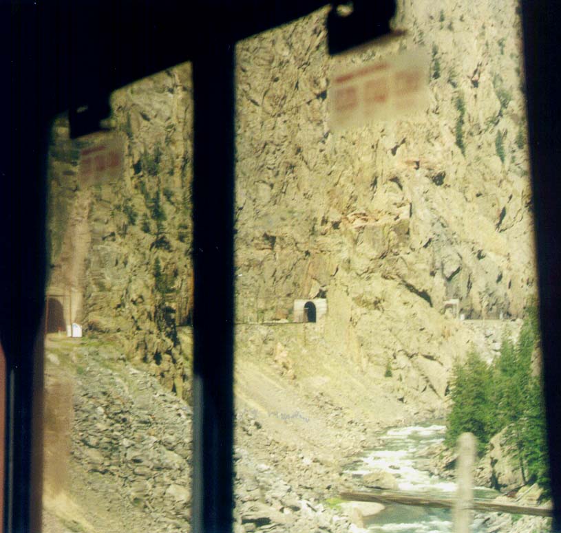 |
From aboard Amtrak No. 5: the west portals of tunnels 37 (at left) and 36 (center of frame) are visible above the river. (August 5, 2001) | ||
 |
Tunnel 38Amtrak No. 5 passes through short Tunnel 38 in Gore Canyon on 8/09/2007. Seen from the overlook on Trough Road (actually, down the hill a bit from the road). | ||
  |
Tunnel 40.Top: Not the greatest scan, but off in the distance you can see the west portal. This is located a few miles east of Radium, and is the centermost of three tunnels between Radium and Azure. The tunnel is only 63 feet in length. The canyon of the Colorado here is confined but not precipitous, and very popular with river-rafters (and therefore, Zephyr Salutes are common!).Bottom: A closer view, taken out the back door of Amtrak in 2011 by David Standen. Notice you can see through the tunnel even on this curve; it’s very short.NEW IMAGE | ||
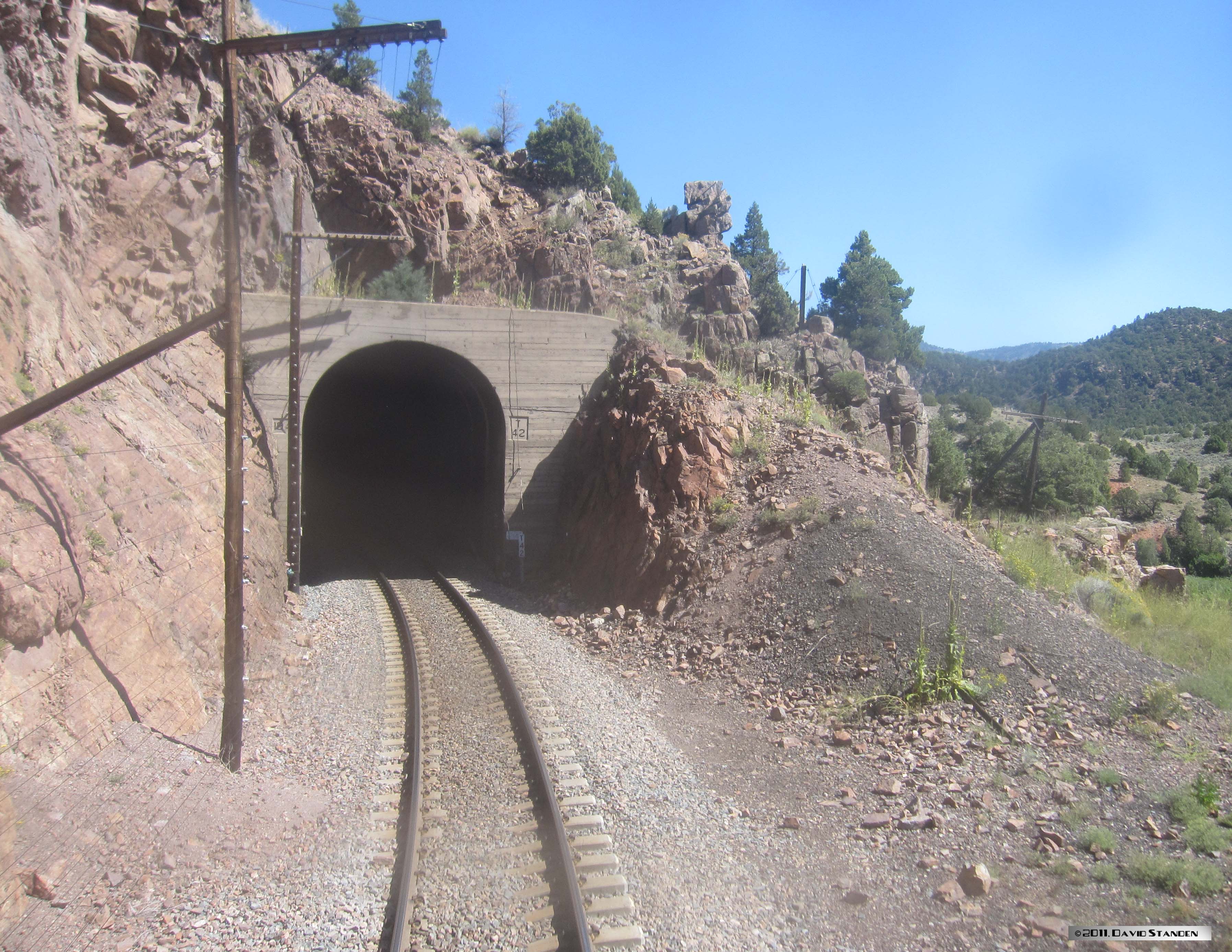 |
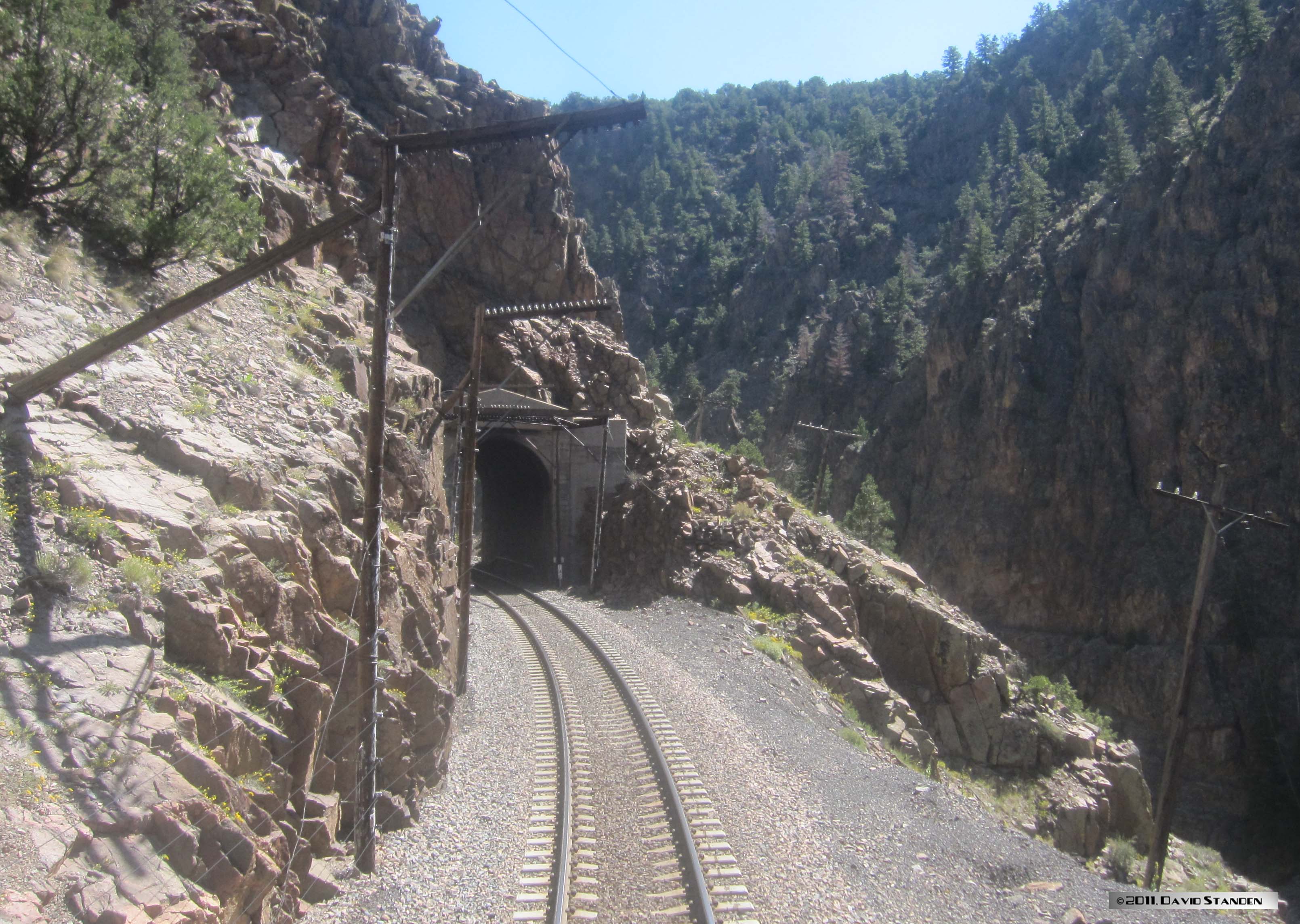
Tunnel 42Again, taken by David Standen on the same trip as above. This is the west portal. The tunnel is 463 feet in length. NEW IMAGE | ||
 |
Here’s the west portal of Yarmony tunnel, just west of Bond. Photo by David Standen. (9/05/2011) | ||
 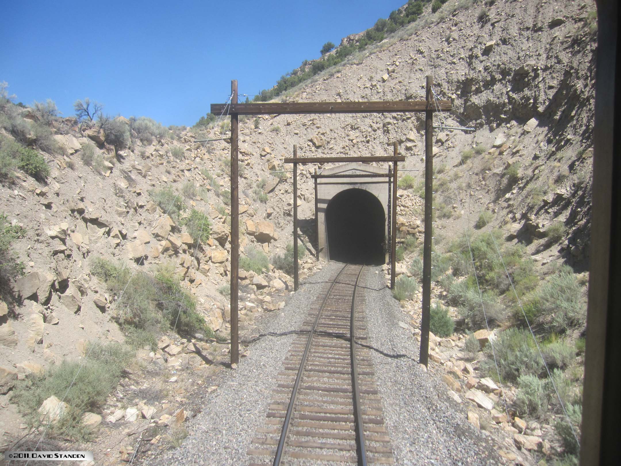 |
Sweetwater TunnelTop: This is the east end of (1,115′), midway along the Dotsero Cutoff, just west of Range. Amtrak train No. 6 is just exiting the bore. This tunnel was dug as part of the cutoff’s construction and opened for service in 1934. (5/31/2019)Bottom: The west portal, taken by David Standen from Amtrak’s rear window in August 2011. NEW IMAGE | ||
  |
Tennessee Pass TunnelTop: This is the west portal of (geographically north). This is the “newer” tunnel at this location, constructed in 1945, and is 2,550′ in length.(8/09/1982)Bottom: the east portal, taken by David Standen on 8/29/2011, well after the deactivation of the route. Note that you can see the far end. NEW IMAGE | ||
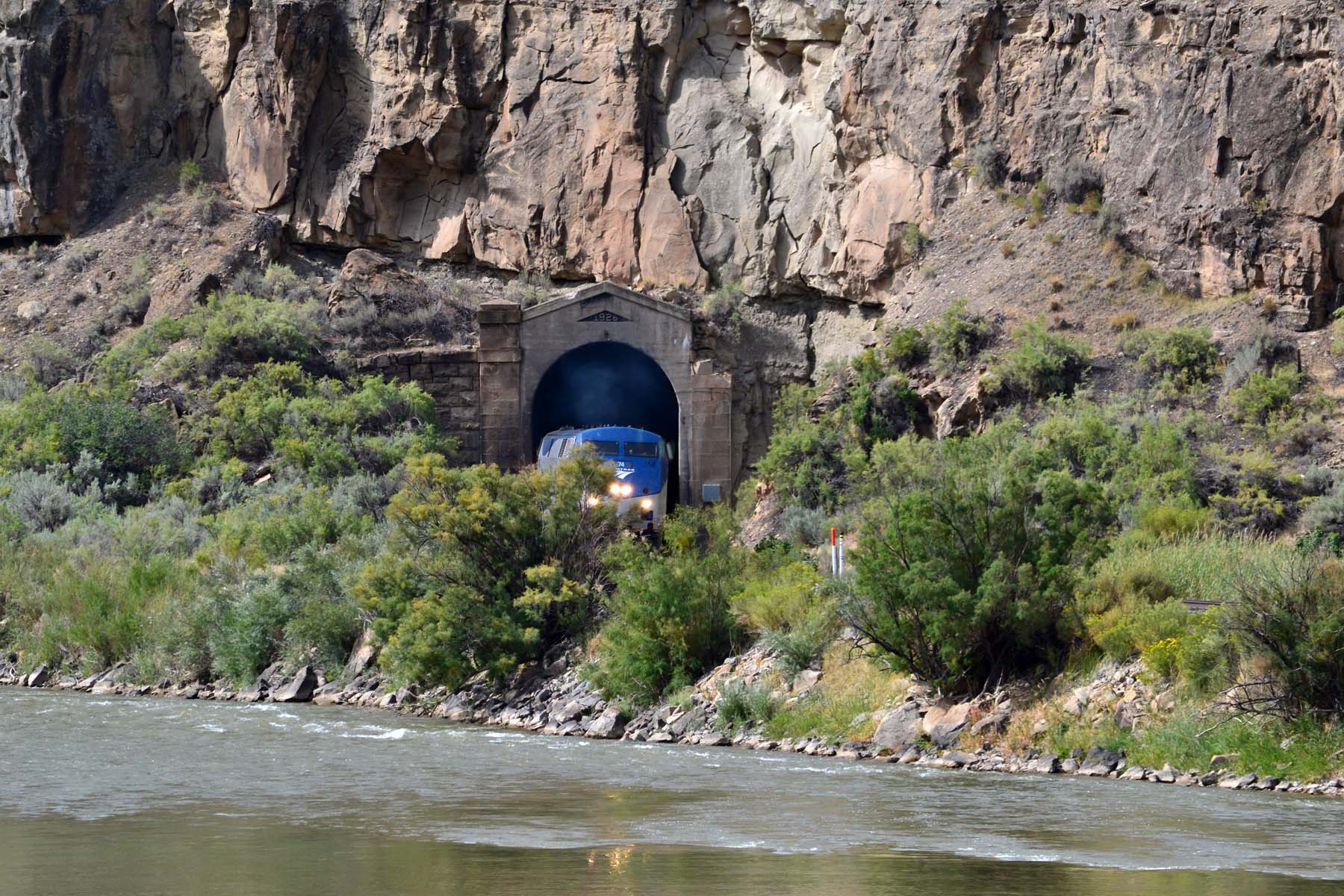 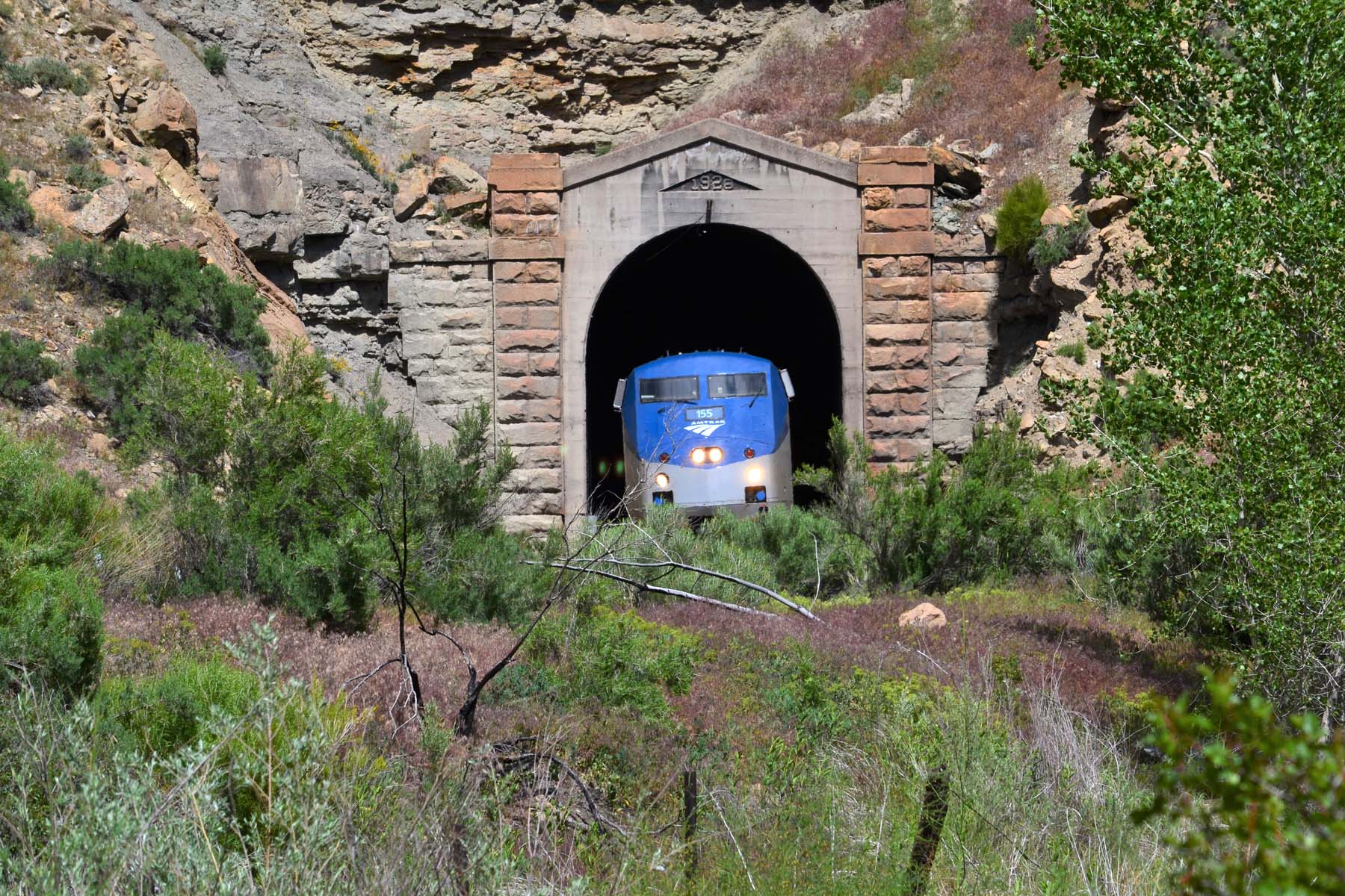 |
Beaver Tail Tunnel (763′), east of Cameo in Debeque Canyon, was bored around 1890 and the tunnel facings improved in 1928.Top: The east portal; Amtrak No. 6 exiting. (9/03/2018)Bottom: The west portal, Amtrak No. 5 exiting. Note the use of local stone for the pilasters. (5/31/2019) | ||
 |
Bridgeport Tunnel (2,252′), the east portal. This tunnel is located south of Grand Junction, partway down the North Fork branch along the Gunnison River. When originally built in late 1883 this was on the narrow gauge mainline, and later (1906) it was enlarged for standard-gauge clearances. However, you can see that the headroom was not improved by much. | ||
 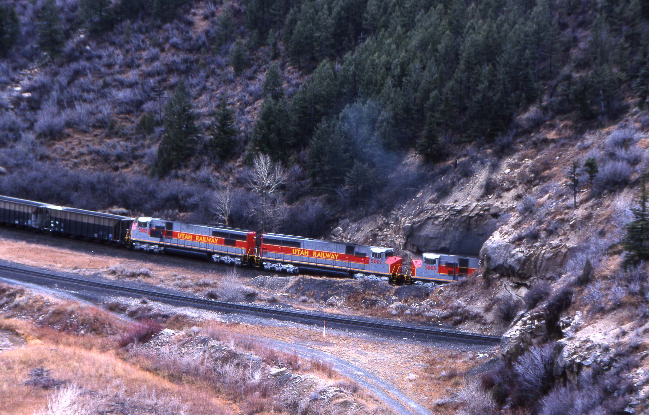 |
The twin Nolan tunnels are located not far above Helper, Utah on the climb to Soldier Summit. Top: a set of Utah Railway helpers are approaching the tunnels on the eastern track. Bottom: Exiting the tunnel going uphill (to the left).(11/10/2001) |
||
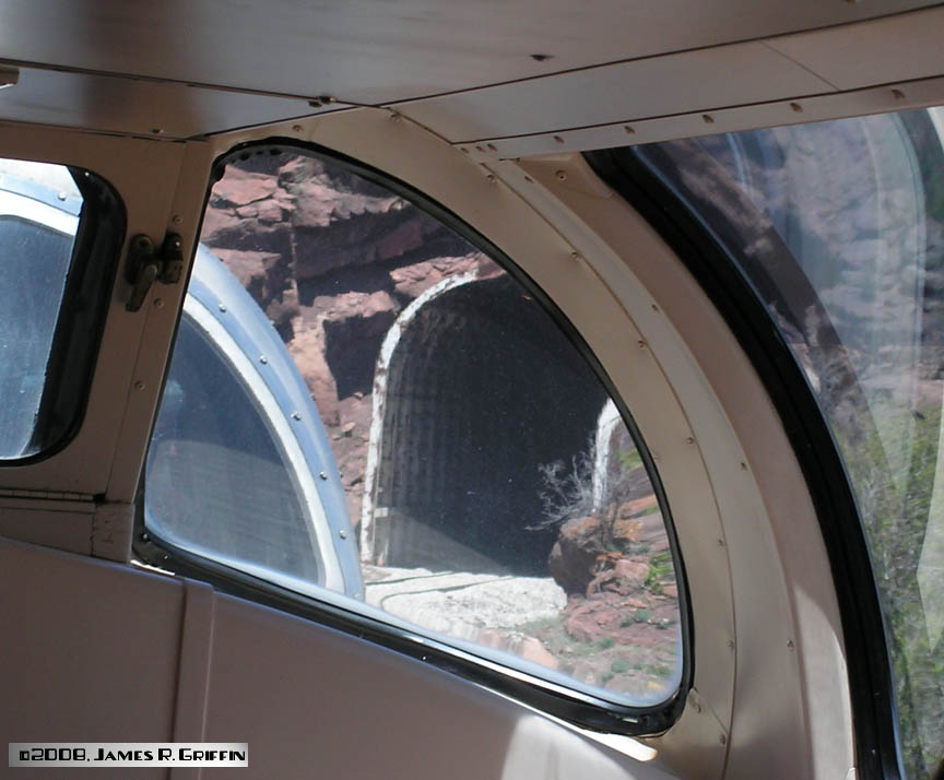 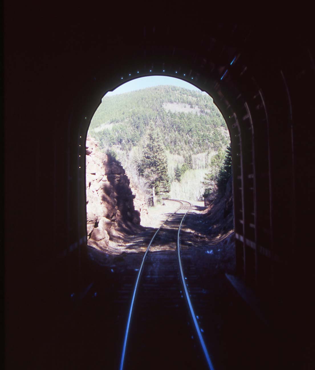 |
The 1899 line between Walsenburg and Alamosa actually has two tunnels. The lower one (655′) is just west of Occidental siding, and is seen in these two views from aboard the Rio Grande Scenic train on 5/24/2008. Top: the west portal, seen through the dome glass. Unfortunately this was the best view I could get. Note the steel portal extending out from the rock face, primarily to keep rocks off the right-of-way. Bottom: looking out of the east portal. There is a steel portal protecting this end as well. (I was on the train; I did NOT walk in here. Incidentally, it’s amazing how humid it is in a tunnel when your train is being pulled by a steam engine!) |
||
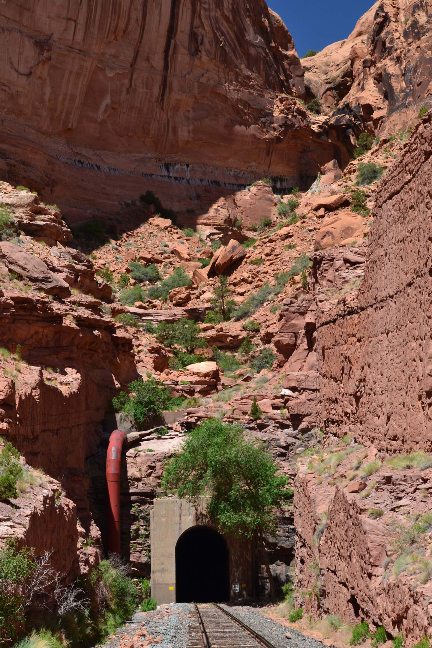 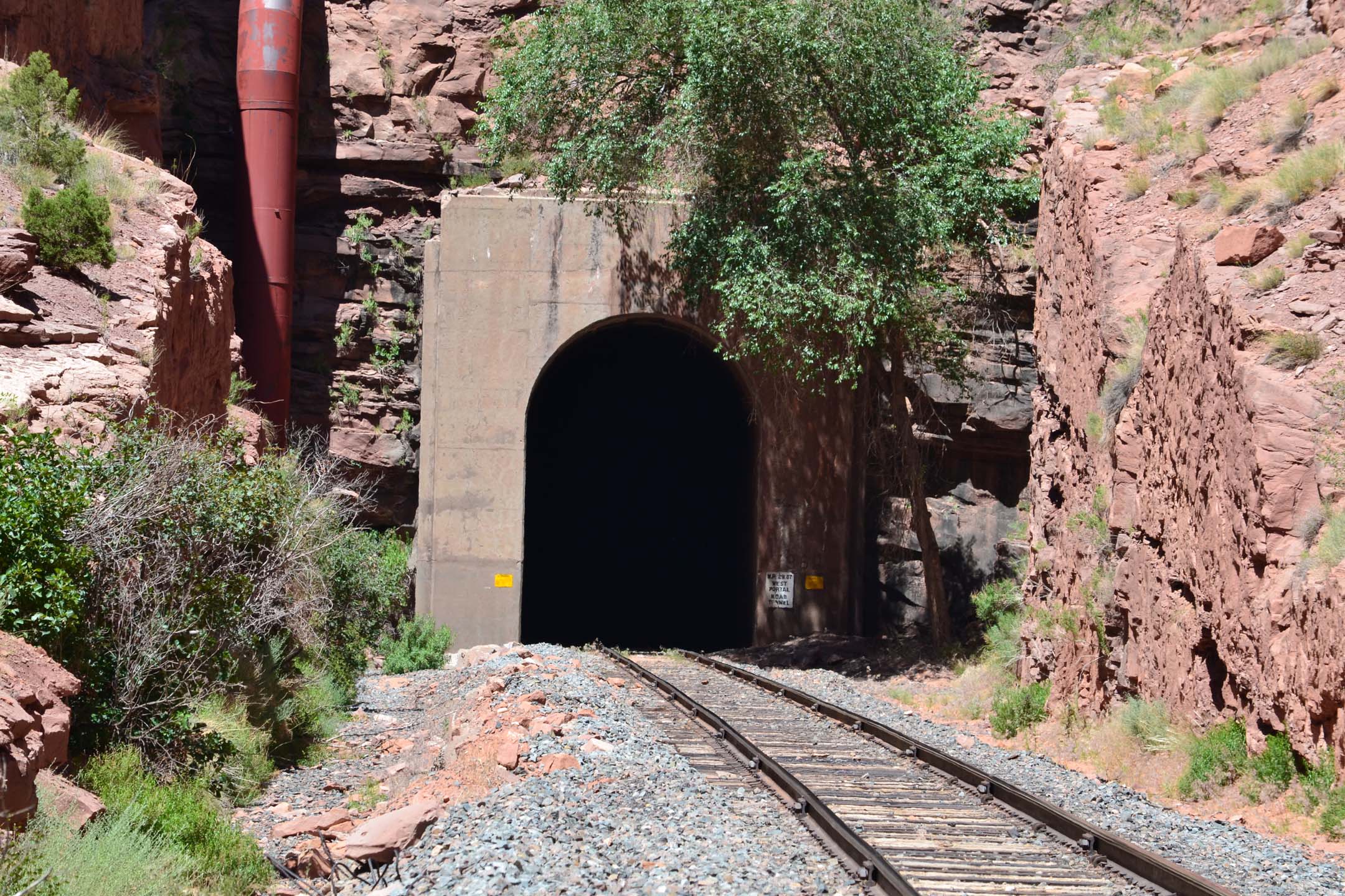 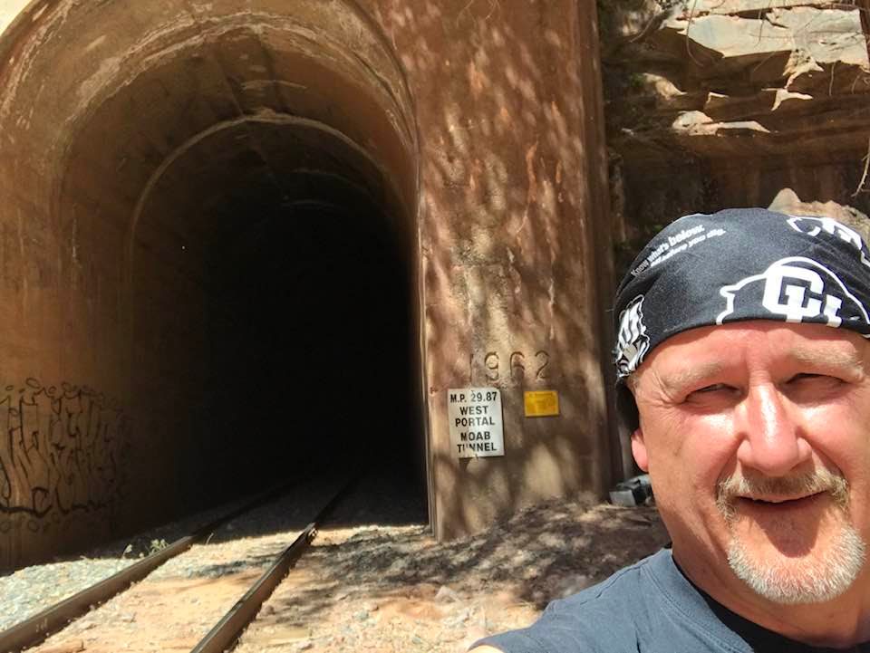 |
Cane Creek branch (Moab) tunnel (7,075′). Constructed 1962. Top: the tunnel in context. The south portal is located in a notch in Poison Spider Mesa, within a runoff channel. On the occasion of a rainstorm a lot of water flows through here. So Morrison-Knudson, the contractor for the construction, built a catch basin above the portal with a large runoff pipe to redirect water around the portal and into the natural channel along the west side of the right-of-way.Center: closer look at the structure. There is just enough moisture to support some foliage– barely.Bottom: Me, showing you what 108 degrees feels like. Behind me are the no-trespassing signs warning you of dire federal consequences if you go into the tunnel (and you’re not a train, I guess?). The other sign which says “Moab Tunnel” seems to be of Union Pacific origin; prior to that the tunnel had other, informal names but nothing official.NEW IMAGES |
||
 |
Yes, the narrow gauge lines had a couple of tunnels too! This is Rock Tunnel (366′), the eastern portal, seen from the open gondola on a C&TS ride on September 22, 2018. | ||
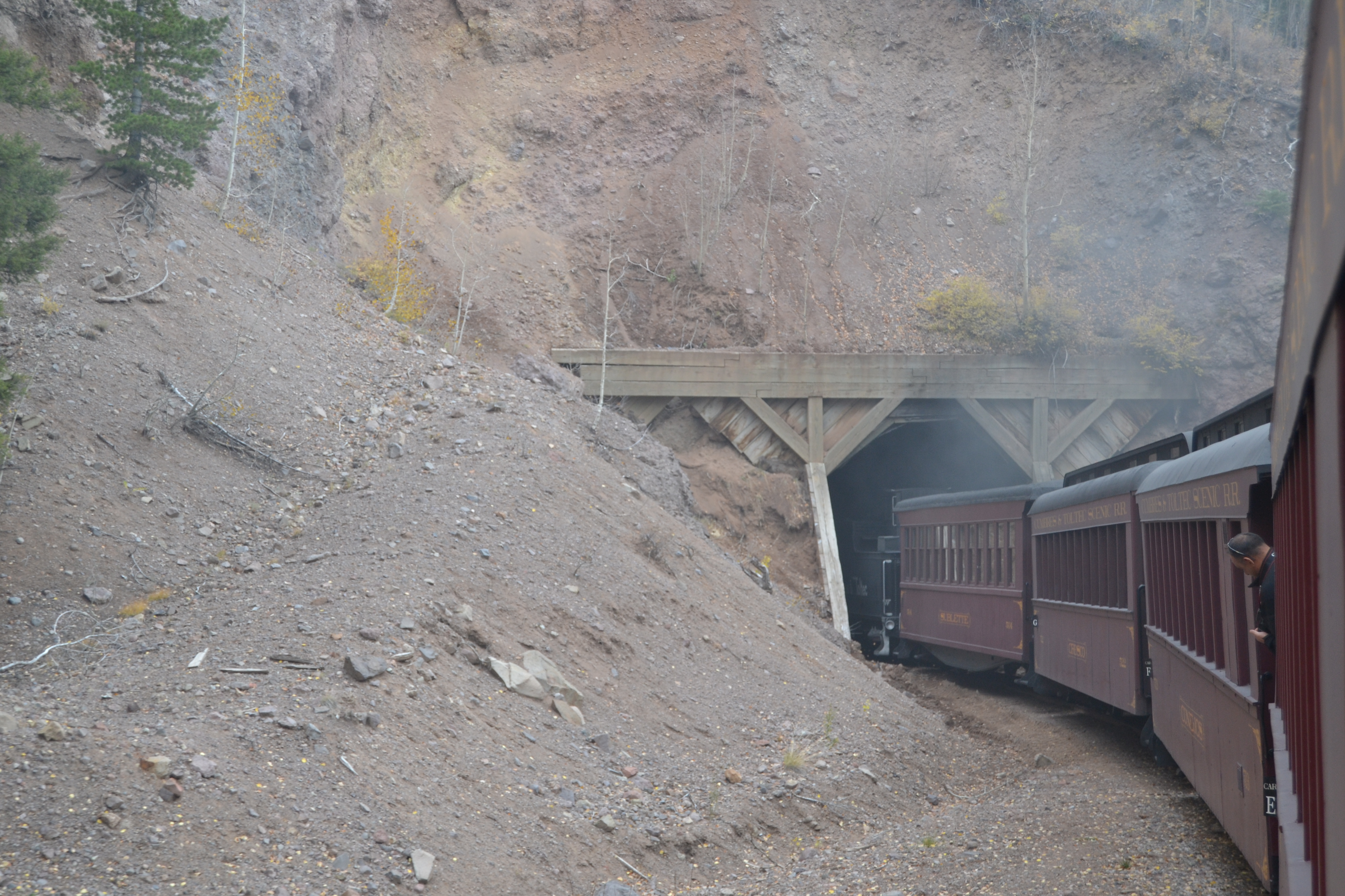 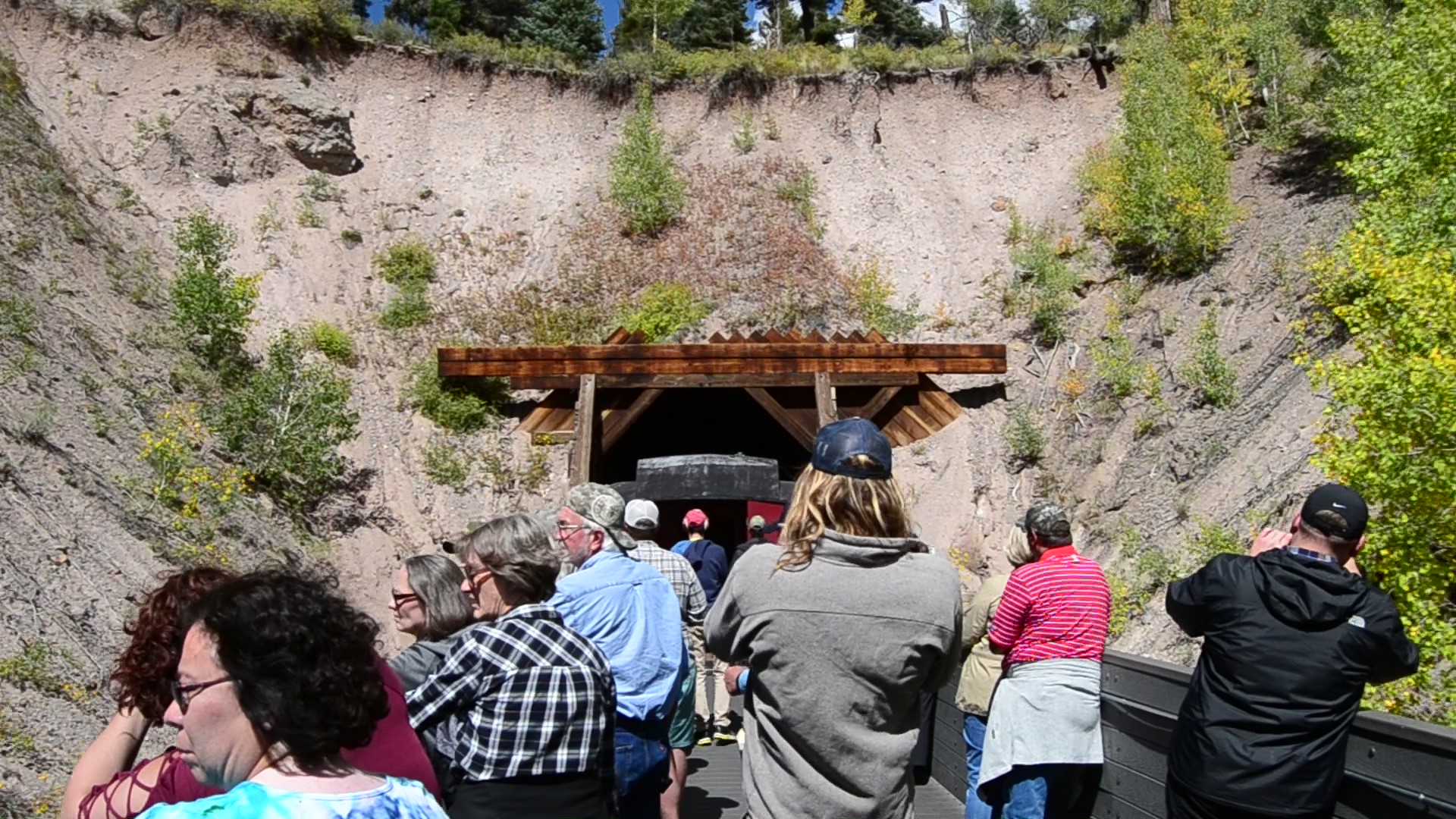 |
Mud Tunnel (349′), west of Antonito.Top: this is the west portal. It’s so named due to the softer geology, which also requires reinforcement as seen here (10/18/2014).Bottom: the east portal, from aboard a westbound C&TS train on 9/22/2018. | ||
Scenes and Sites: Miscellany
|
|||
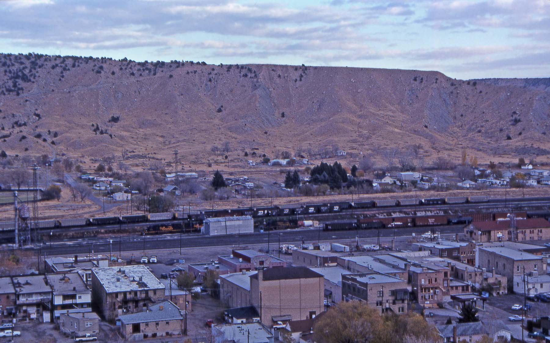 |
Here is an overview of the famous railroad town of Helper, Utah. For many years it has served as a helper base for westbound trains going over Soldier Summit, as well as a miniature classification yard for local traffic and others. Look carefully and you can see four D&RGW tunnel motors in the yard. (November 10, 2001) | ||
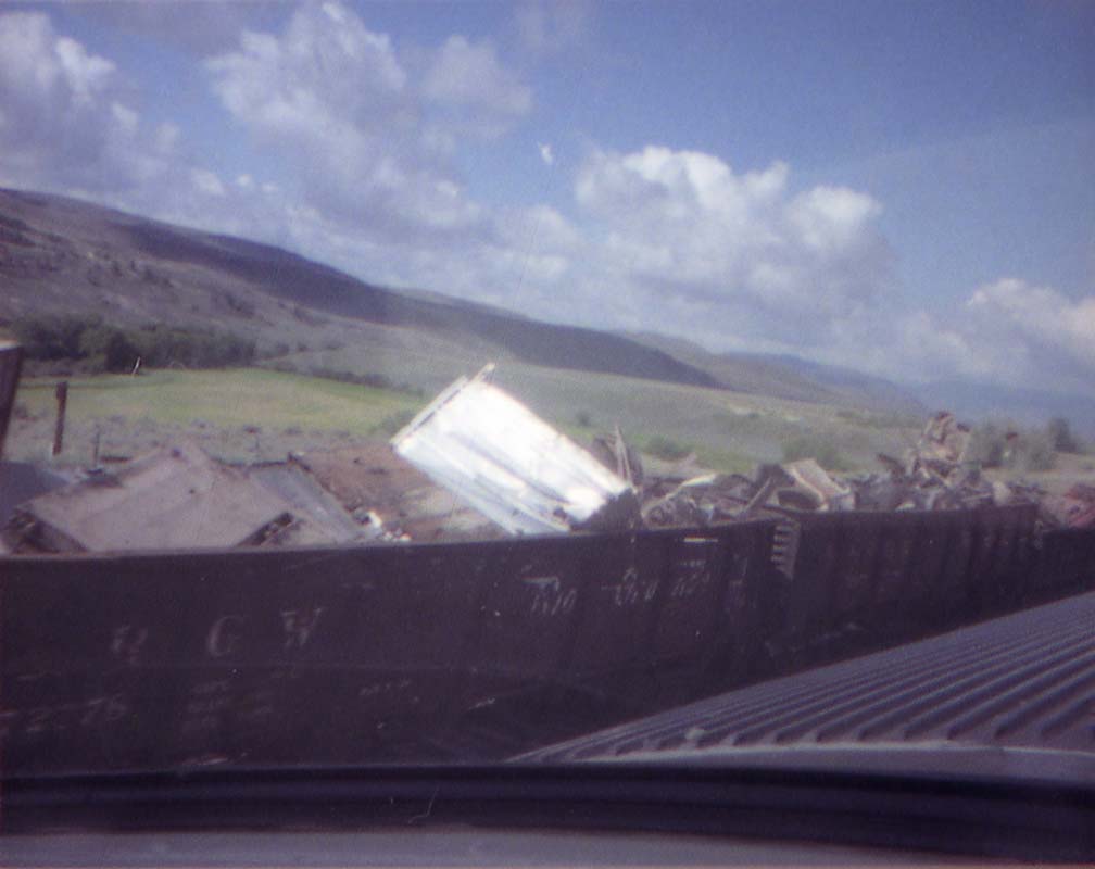 |
Something completely different: a wreck cleanup. On August 7, 1982 (the day we got married, as it happens), an eastbound Rio Grande freight entered the west end of Byers Canyon at an excessive speed. There’s an extremely sharp curve here (20 degrees). The lead locomotive made it around the 20-MPH curve going 57 MPH, but all the trailing units left the rails, as well as a substantial portion of the train. One week later, I took this photo from onboard the Rio Grande Zephyr. A number of gondola cars were parked on the house track at Flat (just west of Parshall), loaded with pieces of the wreckage from the cleanup. | ||
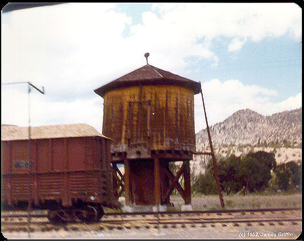 |
Near the operational end of the Creede branch, in the town of South Fork, there was until 2000 a pulpwood mill that shipped carloads of wood chips. There is also an old water tank from the steam days. The tank is still there, though the mill is completely gone now. | ||
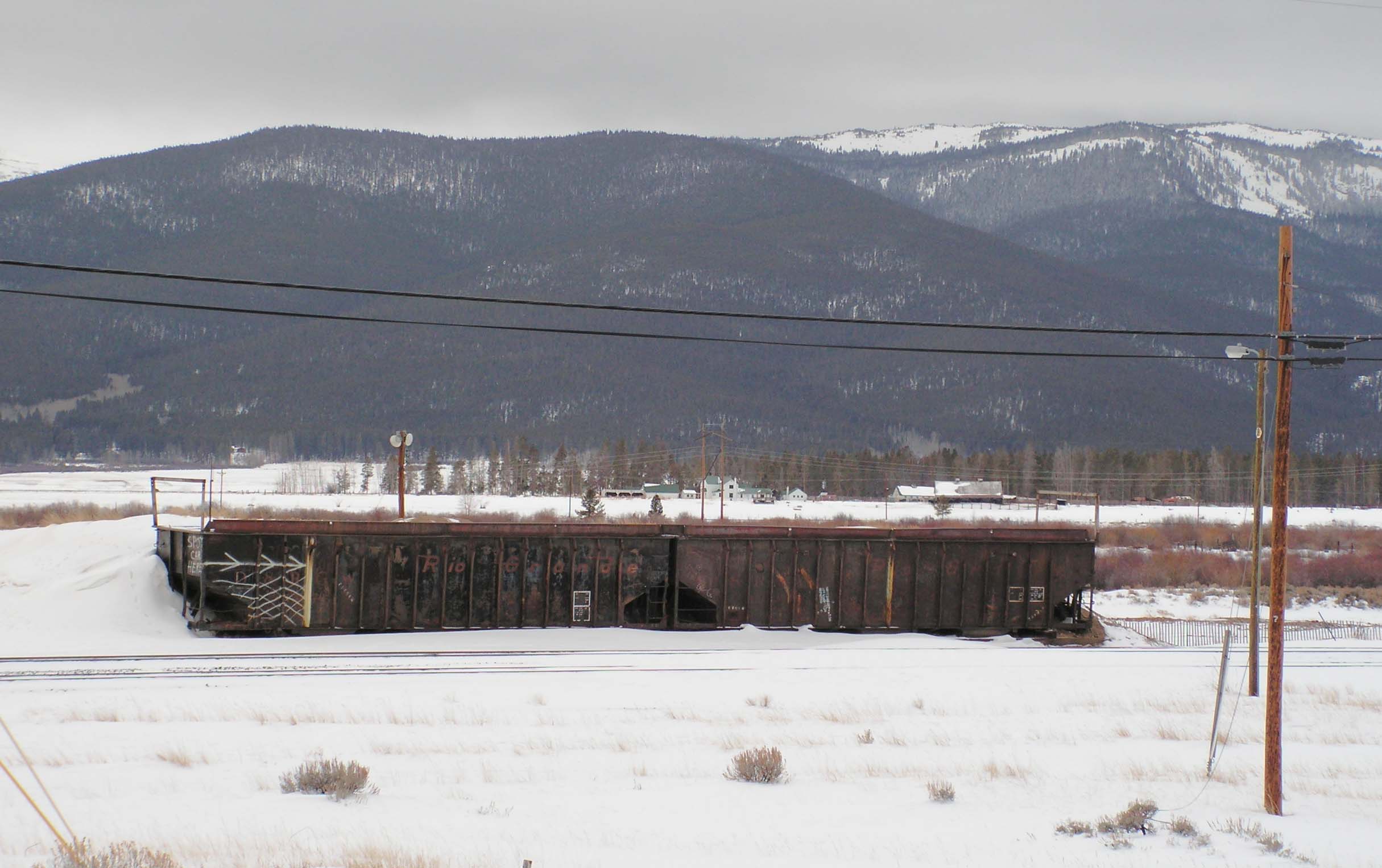 |
At Malta (the junction where the short Leadville branch connected to the main line), there still sits a home-made truck loadout. It was built from a couple of surplus hopper cars for some reason. Most recently (up to say 1997), trucks would back onto the ramp and dump their loads into open gondola cars. (12/06/2008) | ||
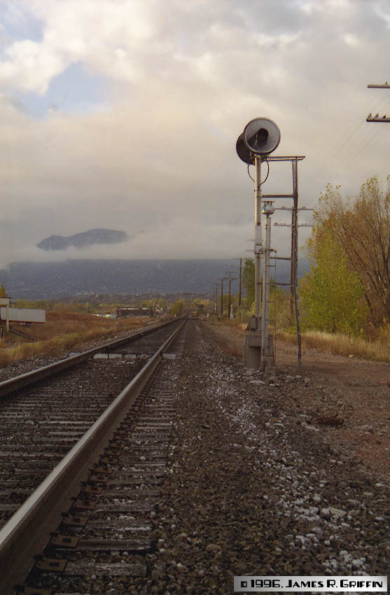 |
A tranquil scene (translation: disappointing because no trains came past!) searchlight signals on the Joint Line in north Colorado Springs. That’s Cheyenne Mountain wreathed in cloud in the distance. This portion of the Joint Line is single-track, thanks to Santa Fe abandoning its alignment through the Springs in 1974. Now it’s an operational bottleneck. (October 1996)The following day I watched a northbound freight with 11 units pass here. Did I have a camera with me? No, of course not. | ||

